Author: TN

  • Northern Mariana Islands: The Pacific’s Hidden Paradise

    Northern Mariana Islands: The Pacific’s Hidden Paradise

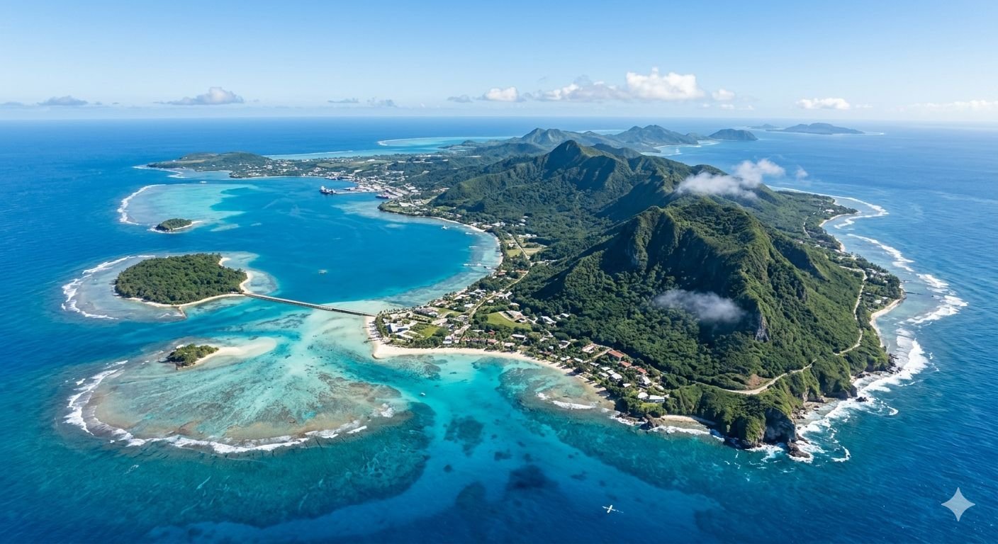
    Tucked away in the western Pacific Ocean, the Commonwealth of the Northern Mariana Islands (CNMI) is one of the most underrated and underexplored destinations in the entire world. A U.S. commonwealth made up of 14 islands, with Saipan, Tinian, and Rota being the largest and most popular among visitors, the Northern Mariana Islands are known for their turquoise waters, lush landscapes, and rich World War II history. They attract travelers with scenic beaches, diving opportunities, and a fascinating blend of Chamorro, Carolinian, and American cultures.

    Despite their extraordinary natural beauty, dramatic history, and warm tropical climate, these islands remain far less visited than comparable destinations in the Pacific. Most tourists who visit come from South Korea or Japan to get a taste of the United States in the western Pacific Ocean. However, these Commonwealths of the United States remain far lesser known in their parent country than Puerto Rico. For the traveler willing to make the journey, the reward is an archipelago of breathtaking variety — volcanic peaks, coral reefs, ancient stone monuments, jungle trails, and WWII relics — all wrapped in the warmth of island hospitality.

    This guide will take you through everything you need to know to plan the perfect trip to the Northern Mariana Islands: its history, its islands, its culture, its food, its outdoor adventures, its practical logistics, and the festivals that bring its communities to life.

    A LAND OF DEEP HISTORY
    Before the beaches and diving, before the resorts and duty-free shops, the Northern Mariana Islands carry the weight of thousands of years of human civilization.

    Ancient Origins
    The first known Northern Mariana Islands residents arrived from the Philippines, Indonesia, and the Malay Peninsula around 2,000 BC. These Chamorro people, as they came to be known, built their homes and other significant structures on giant pillars of latte stones. Tinian’s House of Taga and Rota’s As Nieves Latte Stone Quarry are the two most impressive surviving structures from this era.

    Archaeologists reported findings in 2013 indicating that the people who first settled the Marianas arrived after making what may have been the longest uninterrupted ocean voyage in human history at that time. They further suggested that Tinian is likely to have been the first island in Oceania to have been settled by humans. This makes the Mariana Islands not just a tropical getaway, but one of the most historically significant locations in all of human migration.

    The most important identifying symbol of the Chamorro people, displayed on the flag of the CNMI, is the latte stone — carved limestone columns designed as raised foundations for living and ceremonial structures. Parallel double rows of much taller latte pillars topped by separate capstones are all that remain of what must have been enormous structures throughout the archipelago. Every Culture

    The Colonial Era
    In 1521, Spanish explorer Ferdinand Magellan became the first European to land on the Northern Mariana Islands. After the islands became Spanish territory, Chamorro farmers, hunters, and fishers pillaged items from Magellan’s ships, which caused Magellan to first name these territories “the islands of the thieves.” The islands were later renamed the Marianas after Spanish King Philip IV’s widow, Maria Anna, in 1668.

    A permanent Spanish mission began in 1668, bringing Catholic evangelization and colonial administration. This period included intense conflict between Chamorro communities and Spanish forces, alongside disease and social disruption. Over time, Catholicism became deeply rooted, blending with local traditions.

    The biggest influences from the islands’ centuries of Spanish occupation are the Roman Catholic religion, practiced by about 90 percent of residents, the Spanish-style churches scattered throughout the islands, and Spanish-influenced cha-cha dancing.

    World War II
    Perhaps no chapter of the islands’ history is more viscerally present for the modern traveler than World War II. The island chain saw significant fighting during World War II. Guam, a possession of the United States since 1898, was captured by Japan on the day of the Japanese attack on Pearl Harbor. In 1944, the United States captured the Mariana Islands chain from Japan. Once captured, Saipan and Tinian’s islands were used extensively by the United States military as they finally put mainland Japan within round-trip range of American B-29 bombers.

    Tinian was a key location in WWII, where the atomic bombs were loaded before being dropped on Japan. The runways from which the Enola Gay departed for Hiroshima are still visible on Tinian today — a sobering and deeply moving reminder of the island’s role in the final chapter of the war.
    The combination of ancient Chamorro civilization, centuries of Spanish rule, brief German and Japanese administration, and American influence has produced a culture unlike anywhere else on earth.

    THE THREE MAIN ISLANDS
    Saipan — Gateway to the Marianas
    Saipan, the capital and largest island, serves as the international gateway and commercial hub of the Marianas. It boasts stunning white sand beaches, crystal-clear turquoise waters, and vibrant coral reefs perfect for snorkeling and diving.

    Over 90 percent of the nearly 54,000 Northern Marianas Islands residents live in Saipan, by far the largest and best-known of the islands. The island’s busiest district, Garapan, functions as the commercial and tourist heart of the CNMI, lined with restaurants, shopping centers, and hotels catering to visitors from across Asia and beyond.

    Saipan’s coastline is extraordinarily varied. Calm lagoons on the western shore are ideal for swimming and water sports, while the eastern coast offers dramatic cliffs and crashing surf. The iconic Grotto, one of the most famous dive sites in the Pacific, is a cathedral-like underwater cavern carved into the limestone cliffs of Saipan’s northern tip. From the ideal beginner scuba diving spot of Lau Lau Beach to the dramatic underwater caverns of Saipan’s Grotto, the waters beneath these islands are loaded with WWII shipwrecks and colorful marine life.

    On land, Mount Tapochau — Saipan’s highest point — offers panoramic views of the entire island and the surrounding Philippine Sea. The summit can be reached via a moderately challenging trail through jungle terrain. Nearby, the haunting sites of Suicide Cliff and Banzai Cliff stand as memorials to the tragic final days of the Battle of Saipan in 1944, when thousands of Japanese soldiers and civilians chose death over surrender.

    The American Memorial Park, a national park dedicated to preserving the history of World War II, features exhibits related to the war, including materials and videos. Admission is free, making it a must-visit destination. Set within a beautifully maintained, spacious park filled with flowers and greenery, it also offers a nearby beach and a scenic coastal path.

    Just a short boat ride away, the idyllic islet of Managaha offers pristine shores and excellent water activities, making it a must-visit spot for tourists. Surrounded by shallow turquoise waters teeming with marine life, Managaha is perfect for snorkeling, kayaking, parasailing, and simply lounging on one of the most picturesque beaches in all of Micronesia. Despite its small size, it is well-equipped with restaurants, gift shops, showers, and lockers, allowing visitors to spend a comfortable and worry-free time.

    One of the most famous tourist destinations is Bird Island, located south of Mañagaha Point in Saipan, situated about 50 meters offshore. This island is a designated nature reserve and serves as a perfect habitat for many seabirds. With a visibility of over 30 meters, its breathtaking aquamarine waters leave a lasting impression. There is an observation deck on the opposite shore where visitors can enjoy birdwatching, and nearby caves to explore.

    Tinian — History and Hot Peppers
    Tinian, a neighboring island just three miles south of Saipan, is easily accessible through a short hop on a plane. Known for its unique take on Chamorro food fused with local hot pepper, Tinian offers a culinary experience that delights the senses. Rich in World War II history, visitors can explore significant sites such as North Field, where the Enola Gay took off for

    Hiroshima.
    Beyond its wartime significance, Tinian has a peaceful, rural character quite different from bustling Saipan. The island has many World War II historical sites, cattle ranches, and beaches. Its flat terrain and well-preserved ancient Chamorro latte stone sites make it ideal for cycling and exploration at a relaxed pace.

    The House of Taga — a cluster of enormous latte stones believed to be the remains of a great chief’s home — is one of the most awe-inspiring prehistoric sites in Micronesia and is listed on the National Registry of Historic Places.

    Tinian is also home to the annual Pika and Beer, Beef, and Band Festivals, lively community celebrations that give visitors an authentic taste of island life, complete with live music, grilled meats, and the fiery local hot peppers that Tinian is famous for throughout the region.

    Rota — The Friendliest Island
    Nicknamed “The World’s Friendliest Island,” Rota is known for its friendly nature, sweet potatoes, and coconut crabs. Dip your toes in the Swimming Hole or view thousands of endemic bird species at the Rota Bird Sanctuary.
    Rota is the most pristine and least developed of the three main islands, making it a paradise for travelers who want to escape the crowds entirely. Its coral reefs are considered among the healthiest in all of Micronesia, largely because the island has seen far less human impact than its neighbors. Divers come specifically to Rota for its extraordinary visibility and the sheer abundance of marine life, including manta rays, sea turtles, and dense schools of tropical fish.

    Rota offers a unique atmosphere for outdoor vacation visits, with geographic affinities making it a haven for scuba diving enthusiasts, coffee lovers, golfers, and those seeking a rich cultural experience.

    The Rota Latte Stone Quarry — a prehistoric site where enormous limestone columns were shaped directly out of the hillside — is one of the most mysterious and remarkable archaeological sites in the Pacific. Some pillars weigh up to 35 tons, and it is not known how the heavy pillars were moved to their current location.

    The Remote Northern Islands
    The Northern Islands, known as Gani in the indigenous Chamorro language, feature black sand beaches and the only active volcanoes found in the Marianas. Accessible primarily by private vessels, these remote islands offer unparalleled adventures for those seeking uncharted trails, dramatic volcanic terrains, and hidden waterfalls. For the truly adventurous traveler, the northern islands of Pagan, Agrihan, and Anatahan offer some of the most dramatic and completely unspoiled volcanic scenery in the Pacific.

    CULTURE AND PEOPLE
    The Marianas are a unique melting pot of history, culture, and natural beauty unlike anywhere else in the world. Chamorro and Carolinian cultures live alongside Eastern and Western influences. WWII history is ever present, and the landscape is both lush and dramatic, all surrounded by waters of incredible blues.

    The culture of the CNMI is varied due to a colonial history with Spain, Germany, and Japan as well as its current relationship with the United States. The Northern Mariana Islands is home to two indigenous groups: the Chamorros and the Carolinians.

    The Catholic Church and its calendar dominate Chamorro symbolic rituals. Every community has a saint’s day, and the major seasonal holidays are occasions for family and community feasting. Visitors who happen to be in a village on a fiesta day will witness something genuinely special — an outpouring of communal generosity, music, traditional dance, and home-cooked food that reflects the warmth of island culture.

    Culturally, the Marianas reflect a blend of Indigenous Chamorro and Carolinian traditions alongside influences from the wider Pacific and beyond. Visitors often notice this in local food, language, festivals, and everyday life, where community and family ties play a central role.

    The NMI Museum of History and Culture, located in what was once a Japanese hospital built in 1926, houses collections and exhibits focusing on local history and culture, including artifacts from ancient Chamorro culture, Carolinian culture, and the Spanish, German, Japanese, and post-World War II periods. It is an essential stop for anyone wanting to understand the complex layered story of these islands.

    The islands host many festivals, including a sweet potato festival, a hot pepper festival with a hot pepper eating contest, and a fishing derby. One of the longest-running festivals, the Flame Tree Arts Festival, highlights traditional stick dancing, an ancient warrior dance.

    FOOD AND DINING
    The food of the Northern Mariana Islands is a delicious reflection of the islands’ multicultural heritage.
    The Chamorro people have influenced many popular dishes, including motsiyas, a mixture of ground chicken, hot pepper leaves, mint, lemon juice, salt, and pepper; and kelaguen, made with meat or seafood, coconut, and lime. Lumpias, fried spring rolls, are eaten at family celebrations throughout the islands. Because of the culture’s Spanish influence, rice is a popular ingredient in many dishes.

    Local dishes such as red rice, kelaguen, and titiyas (flatbread) are found in local eateries throughout the islands. Red rice, colored and flavored with achote seeds, is the backbone of nearly every traditional meal and appears at everything from roadside barbecues to elaborate family fiestas.

    Rota is particularly known for its coconut crabs, which are considered a local delicacy. These enormous land crabs, capable of cracking open coconuts with their powerful claws, are a uniquely Micronesian treat and are best savored in a simple preparation that lets their rich, sweet flavor speak for itself.

    Thanks to its multicultural inhabitants, the Northern Mariana Islands has many types of food available, from traditional Chamorro and Carolinian food to Filipino, Chinese, Thai, Korean, and even Mexican food. For fresh fruit and vegetables, visitors can go to the weekly Sabalu Farmers Market on Saturday mornings at Civic Center Park in Susupe. The Annual Taste of the Marianas International Food Festival is held on Saturdays in May and features local and international cuisine, cooking contests, and live entertainment at the American Memorial Park on

    Saipan.
    Saipan is also filled with common American chain restaurants like McDonald’s, Taco Bell, and Hard Rock Café. The islands are firmly American territory in terms of food infrastructure, so visitors will never be at a loss for familiar options, even if the local cuisine is far more rewarding.

    OUTDOOR ACTIVITIES AND ADVENTURES
    Water Sports and Diving
    The waters surrounding the Northern Mariana Islands are arguably the islands’ greatest treasure. The waters surrounding the islands are home to over 1,000 species of fish, corals, and marine creatures, making it a diver’s paradise.

    Parasailing over Saipan’s lagoon, windsurfing with help from refreshing tropical trade winds, and catching fish from towering precipices are among the many ways to enjoy Northern Mariana Islands waters. Key dive sites include the Chinsen shipwreck, Managaha Island, Lau Lau Beach’s coral reef, and Saipan’s Grotto’s underwater caverns.

    The Grotto deserves special mention. Accessed by a staircase carved into the cliff, it opens into a massive cavern partially open to the sky and connected to the open ocean through three underwater tunnels. The play of light through the cavern creates an otherworldly blue glow that divers from around the world travel specifically to experience.

    Land Activities
    The most popular dry land activities include mountain biking across mountains and jungles, and golfing on courses designed by the likes of Greg Norman and Larry Nelson. Golf in the Marianas is a particular draw, as the courses offer stunning ocean views and year-round warm weather.

    Hikers will find trails ranging from gentle coastal walks to more demanding ascents through jungle and volcanic terrain. Mount Tapochau on Saipan and the trails leading to Forbidden Island — a remote beach accessible only by a rocky coastal hike — are among the most rewarding routes on the islands.
    Tinian also offers horseback riding, fishing, and the exploration of its ancient temples.

    FESTIVALS AND EVENTS
    Liberation Day, celebrated on July 4th across the islands, marks the liberation from Japanese forces in WWII with parades, music, and fireworks. The San Vicente Fiesta is a Catholic festival in honor of Saipan’s patron saint, celebrated with music, food, and traditional dances in October. The Tinian Hot Pepper Festival, held in February, celebrates the Tinian hot pepper with spicy food and contests. The Marianas March Against Cancer is a community event held in May in Saipan.

    The Flame Tree Arts Festival — named for the brilliant red flame trees that bloom across the islands — is one of the most beloved annual events, showcasing traditional Chamorro and Carolinian arts, crafts, dance, and music in a vibrant multi-day celebration.

    The Saipan International Fishing Tournament draws competitive anglers from across the region, celebrated with awards and seafood feasts. For visitors with a passion for food, the hot pepper festivals on Tinian are a fiery, unforgettable experience that celebrates one of the island’s most prized agricultural products.

    PRACTICAL TRAVEL INFORMATION
    When to Go
    The best time to visit the Northern Mariana Islands is from December to May, during the dry season. This period offers sunny skies, pleasant temperatures, and lower humidity, ideal for beach activities, hiking, and exploring cultural sites. The wet season runs from July through November and brings heavier rainfall and the possibility of typhoons, though the islands remain warm and largely accessible even during wetter months.
    Once you step off the plane, you’ll find yourself on a tropical island with an average temperature of 28°C (about 82°F). The climate is consistently warm year-round, making almost any month a reasonable time to visit.

    Getting There
    North American tourists must first fly to South Korea, Japan, China, or Guam before proceeding to the only Northern Mariana Islands international airport. There are currently no direct flights between Saipan International Airport and the mainland United States. From East Asia and Southeast Asia, however, the islands are very accessible, with multiple airlines serving Saipan directly from Seoul, Tokyo, and other major hubs. A direct flight from Narita Airport to Saipan International Airport takes only 3 hours and 40 minutes.

    Getting Around
    Renting a car is recommended for exploring Saipan, as it provides flexibility to visit historical sites, beaches, and cultural attractions. Public transportation is limited, so having a car makes it easy to travel around the island at your own pace. Car rentals are available on Saipan and can also be arranged for nearby islands like Tinian.

    Vehicles rented from Saipan International Airport’s car rental companies are the most practical way to explore the island, whose only public transportation options are taxis and shuttle buses that stop only at the airport, some hotels, and the DFS Galleria shopping mall. Air travel is the quickest way to travel between the Northern Mariana Islands. Star Marianas Air operates small aircraft on routes connecting Saipan, Tinian, and Rota.

    Accommodation
    Most of Saipan’s luxury high-rise hotels are geared toward Asian tourists on package holidays. Hotel rooms are most expensive and hardest to find during Japanese national holidays, especially during the Golden Week holiday period from late April to early May. However, heavy discounts are fairly easy to find during most other times of the year. There are very few lower-budget hotels in Saipan, and fewer accommodations of any kind on the smaller Northern Mariana Islands.

    Money and Tipping
    As a U.S. commonwealth, the currency is the US dollar. Credit cards are widely accepted in Saipan’s hotels, restaurants, and shops. Smaller vendors and local markets often prefer cash, so it is handy to carry some, especially on Tinian and Rota. Tipping of 10 to 15 percent is appreciated but not mandatory.

    Health and Safety
    Generally the CNMI is a healthy place to live and visit. There are no poisonous snakes or insects and no malaria. The infectious diseases usually associated with a tropical climate are not present. Standard travel precautions apply: use sunscreen, stay hydrated in the heat, and exercise care when swimming in areas with strong currents.

    The tropical sun can be intense, so use reef-safe sunscreen, hats, and UV-protective clothing to protect against sunburn. When diving, always dive with a certified operator and respect the marine environment.

    Practical Tips
    Booking popular dive sites like the Grotto in advance is strongly recommended. Managaha Island can be busy on weekends, so visiting on a weekday provides a quieter beach experience. When hiking places like Suicide Cliff and Mount Tapochau, stick to designated paths to preserve nature and ensure personal safety. Learning basic phrases and customs of the Chamorro and Carolinian traditions is appreciated by locals.

    THE MARIANA TRENCH — A WORLD RECORD NEARBY
    No article about the Northern Mariana Islands would be complete without mentioning the Mariana Trench. The lowest point on the Earth’s crust, the Mariana Trench, is located near the islands and is named after them. Stretching to a depth of nearly 11 kilometers (36,000 feet) below the ocean surface, the trench is the deepest place on the planet — deeper than Mount Everest is tall. While visitors cannot dive to the trench itself, the knowledge that you are swimming above one of the most extreme and mysterious environments on Earth adds an almost philosophical dimension to every moment spent in these waters.

    CONCLUSION
    The Northern Mariana Islands offer something rare in the modern world of travel: a destination of genuine, unspoiled magnificence that has not yet been overrun by mass tourism. Here, ancient Chamorro civilization meets the scars and memorials of a world war. Pristine coral reefs stretch beneath crystalline water. Jungle trails lead to clifftops overlooking an infinite Pacific horizon. And the warmth of the people — descendants of some of humanity’s earliest ocean voyagers — makes every visit feel personal and deeply human.

    Whether you come to dive the Grotto, trace the footsteps of history on Tinian, eat coconut crab on Rota, or simply lie on the white sands of Managaha and watch the colors of the Pacific shift from turquoise to deep blue, the Northern Mariana Islands will reward you with memories that outlast any postcard.

    This is not just a beach destination. It is a place where the ocean runs deep in every sense, and where every island has a story that stretches back thousands of years to the very dawn of human exploration. Come, and discover what “far from ordinary” truly means.

  • Wyoming: Untamed peaks, endless horizons

    Wyoming: Untamed peaks, endless horizons

    There are places in the world that feel like they were made to humble you, to remind you that the earth is ancient and vast and indifferent to human ambition. Wyoming is one of those places. The tenth largest state in the United States by area, yet the least populated of all fifty states, Wyoming is a land of almost incomprehensible scale and grandeur. Here, mountain ranges rise abruptly from sweeping high plains, geysers blast boiling water a hundred feet into the air, rivers run cold and clear through canyon walls that took millions of years to carve, and vast herds of bison still roam landscapes that look much as they did when the first European explorers arrived, wide-eyed and speechless, centuries ago.

    Wyoming is a state of extremes. It holds the nation’s first national park, the world’s most famous geyser, some of the most dramatic mountain scenery on the continent, the windiest city in the lower 48, temperatures that swing from scorching summer days to brutal winter cold, and a human population density so low that entire counties have fewer residents than a single city block in Manhattan. It is a state that takes its identity from the land itself, from ranching and rodeo, from open skies and unbroken horizons, from a culture of self-reliance that is not a pose but a genuine necessity shaped by geography and climate.

    For the traveler, Wyoming offers experiences that simply cannot be replicated anywhere else. Whether you come to stand on the rim of a geothermal basin watching the earth exhale steam into a cold morning sky, to hike through wildflower meadows beneath the jagged granite spires of the Tetons, to watch a cowboy work a herd of cattle on a guest ranch, or to lie on your back in a sagebrush field far from any light pollution and stare up at the most star-filled sky you have ever seen, Wyoming has a way of changing your sense of what is possible in the natural world.

    A BRIEF HISTORY
    The land that is now Wyoming was home to Indigenous peoples for at least 13,000 years before European Americans arrived. Dozens of tribes lived in or moved through the region over millennia, including the Shoshone, Crow, Arapaho, Cheyenne, Bannock, Sioux, and others. The Eastern Shoshone, led by the legendary Sacagawea and her people, had a particularly deep and enduring relationship with the Wind River area. Today the Wind River Indian Reservation, home to both the Eastern Shoshone and Northern Arapaho tribes, remains a living and vital community in central Wyoming.

    European American exploration of the region began in earnest in the early 19th century. John Colter, a fur trapper who had traveled west with the Lewis and Clark Expedition, is believed to have been the first non-Native American to see the geothermal wonders of what is now Yellowstone National Park, sometime around 1807 and 1808. His reports of boiling springs, steam vents, and exploding geysers were so fantastical that people back east dismissed them as tall tales, nicknaming the area “Colter’s Hell.”

    The fur trade brought mountain men into Wyoming in increasing numbers through the 1820s and 1830s. The annual Rendezvous, a gathering of trappers, traders, and Native Americans held each summer at sites like the Green River Valley, was one of the most colorful and remarkable events in the history of the American West. By the 1840s, the fur trade was declining as beaver hats went out of fashion in Europe, but Wyoming was already finding its next identity as a corridor for westward migration.

    The Oregon Trail, one of the most important overland routes in American history, passed directly through Wyoming. Between 1840 and 1869, an estimated 400,000 emigrants traveled the trail on their way to Oregon, California, and Utah, passing through landmarks like Fort Laramie, Independence Rock, South Pass, and Fort Bridger, all of which remain important historic sites today. The trail brought settlers, conflict with Native nations, and eventually the infrastructure of permanent settlement.

    The transcontinental railroad arrived in Wyoming in 1867 and 1868, bringing with it the instant cities of Cheyenne, Laramie, and others that sprang up overnight along the tracks. Wyoming Territory was organized in 1869, and in a remarkable act that was decades ahead of its time, the territorial legislature granted women the right to vote that same year, the first government in American history to do so. Wyoming earned the nickname “the Equality State,” and when Wyoming was admitted to the Union as the 44th state in 1890, women’s suffrage remained in its constitution.

    The cattle industry dominated Wyoming’s economy and culture in the latter half of the 19th century, as vast ranches spread across the high plains and cattle drives moved enormous herds to the railroad. The conflicts between large cattle barons and smaller ranchers and homesteaders came to a head in the infamous Johnson County War of 1892, a dark chapter in which powerful cattlemen hired armed gunmen to intimidate and kill their rivals, an event that has become one of the defining stories of the American West.

    Wyoming’s landscape was shaped into protected lands earlier than almost anywhere else. Yellowstone was established as the world’s first national park in 1872. Grand Teton National Park followed in 1929. The state’s ranching, mining, and energy industries have always coexisted in tension with its extraordinary natural heritage, a tension that continues to define Wyoming’s politics and culture today.

    GEOGRAPHY AND LANDSCAPE
    Wyoming’s geography is staggering in its diversity and drama. The state covers 97,813 square miles, making it larger than the United Kingdom, yet it holds fewer than 600,000 people. It sits on the high country of the American West, with an average elevation of about 6,700 feet above sea level, the second highest average elevation of any state after Colorado.

    The Rocky Mountains dominate the western portion of the state. The Wind River Range, running diagonally from the northwest to the southeast through central Wyoming, is arguably the most spectacular and remote mountain range in the contiguous United States. It includes Gannett Peak, Wyoming’s highest point at 13,809 feet, and is home to some of the largest glaciers in the lower 48 states. The Winds, as they are known locally, attract serious climbers, backpackers, and wilderness travelers who want to experience mountains that have not been softened by roads and visitor centers.

    The Teton Range, rising abruptly from the floor of Jackson Hole to the west of the Snake River, is one of the youngest and most dramatically vertical mountain ranges in North America. The peaks have no foothills to speak of; they simply explode from the valley floor in a wall of granite, with the Grand Teton reaching 13,775 feet. The visual impact of seeing the Tetons for the first time, whether from the highway north of Jackson or from the shore of Jenny Lake, is something that stays with a person.

    The Absaroka Range, the Beartooth Range, the Gros Ventre Range, the Wyoming Range, the Salt River Range, and the Laramie Mountains are among the other significant ranges that give Wyoming’s topography its complexity and grandeur.

    The Yellowstone Plateau, sitting in the northwestern corner of the state, is the caldera of one of the largest supervolcanoes on earth. The plateau sits atop a hotspot in the earth’s mantle that has powered volcanic eruptions of almost unimaginable magnitude over millions of years. Today it powers the geothermal spectacle of Yellowstone National Park, the largest hydrothermal system in the world.

    East of the mountains, Wyoming opens into the high plains and basins: the Bighorn Basin, the Powder River Basin, the Green River Basin, the Laramie Basin, and the vast Wyoming Basin. These wide open spaces, covered in sagebrush, grasses, and in some areas dramatic badlands, have their own austere beauty. They are the territory of pronghorn antelope, the fastest land animal in the Western Hemisphere, which roam in herds that can still number in the thousands.

    The Continental Divide crosses Wyoming diagonally, and the state’s rivers drain in two directions. The Snake and Green Rivers flow ultimately to the Pacific. The Yellowstone, the Bighorn, the Powder, and the North Platte flow ultimately to the Atlantic via the Gulf of Mexico.

    YELLOWSTONE NATIONAL PARK
    No honest account of Wyoming as a travel destination can begin anywhere but Yellowstone. Established in 1872, Yellowstone is not only the world’s first national park but arguably its most extraordinary. It encompasses 2.2 million acres of wilderness, more than half the world’s geothermal features, the largest high-elevation lake in North America, vast wildlife populations, ancient forests, dramatic canyons, and waterfalls of breathtaking power. It is, in the truest sense of that overused word, awe-inspiring.

    The geothermal features are what make Yellowstone unlike anywhere else on earth. The park contains more than 10,000 hydrothermal features, including geysers, hot springs, mud pots, and fumaroles. Old Faithful, the park’s most iconic feature, erupts on a reasonably predictable schedule, typically every 60 to 110 minutes, sending a column of boiling water and steam between 100 and 185 feet into the air for several minutes at a time. It has been doing so for centuries and is one of the most watched natural events on earth.

    But Old Faithful, remarkable as it is, is just the beginning. The Grand Prismatic Spring, the largest hot spring in the United States and the third largest in the world, is a staggering sight: a pool of brilliant blue water surrounded by rings of orange, yellow, and green caused by heat-loving microorganisms called thermophiles. Seen from above, it looks like something from another planet. The Norris Geyser Basin, the hottest and most dynamic thermal area in the park, changes frequently as underground plumbing shifts. The Mammoth Hot Springs area features travertine terraces of almost supernatural elegance, formed by hot water depositing dissolved limestone as it flows across the surface.

    Yellowstone’s wildlife is legendary. The park supports one of the largest free-ranging bison herds in the world, with a population of roughly 5,000 animals that roam the valleys and meadows and occasionally bring traffic to a standstill as they cross roads in unhurried, majestic processions. The reintroduction of gray wolves to Yellowstone in 1995 was one of the most significant and successful wildlife conservation events in American history. Today the park’s wolf packs can sometimes be spotted, particularly in the Lamar Valley, which has earned the nickname “America’s Serengeti” for the concentrations of wildlife visible from the road. Grizzly bears, black bears, elk, moose, pronghorn, bighorn sheep, bald eagles, ospreys, and trumpeter swans are among the many other species that call the park home.

    The Grand Canyon of the Yellowstone is a revelation for visitors who arrive expecting primarily geothermal spectacle. The Yellowstone River plunges over two dramatic waterfalls, the Lower Falls dropping 308 feet, nearly twice the height of Niagara, into a canyon of yellow and orange rhyolite walls that stretch for 20 miles. The colors of the canyon walls, caused by hydrothermal alteration of the rock, are extraordinary.

    Yellowstone can be accessed through five entrance gates: the North Entrance at Gardiner, Montana; the Northeast Entrance at Cooke City, Montana; the East Entrance from Cody, Wyoming; the South Entrance from Grand Teton National Park; and the West Entrance at West Yellowstone, Montana. The Grand Loop Road, a figure-eight highway running about 142 miles, connects the major attractions and can be driven in a day, though doing justice to the park requires several days at minimum, and many visitors find that a week is not enough.

    Lodging within the park is operated by Xanterra, the park concessionaire, and ranges from the historic Old Faithful Inn, a masterpiece of rustic architecture built in 1903 and 1904 from lodgepole pine and rhyolite stone, to simple cabins and campgrounds. Old Faithful Inn is one of the great lodge buildings in the world, and staying there, watching eruptions from the porch, is an experience of a lifetime. Lodging within the park books up months in advance, particularly for summer visits.

    Visitor numbers to Yellowstone have grown significantly in recent years, and summer crowds at the most popular features can be substantial. Arriving early in the morning, staying into the evening, and venturing beyond the roadside pull-outs onto the park’s 900 miles of trails are all effective strategies for finding the solitude and wildness that Yellowstone still abundantly offers to those willing to walk a little.

    GRAND TETON NATIONAL PARK
    Just south of Yellowstone, sharing its border, Grand Teton National Park protects one of the most dramatic mountain landscapes in North America. The park covers about 310,000 acres and encompasses the Teton Range, the northern portion of Jackson Hole valley, the Snake River, and a series of glacially carved lakes at the base of the mountains, including Jenny Lake, String Lake, and Jackson Lake.

    The view of the Teton Range from the valley floor is one of those images so often reproduced on calendars and magazines that visitors sometimes wonder if they can possibly live up to the photographs. They do. Standing at the edge of Jenny Lake or at one of the classic viewpoints along the Teton Park Road and looking up at the jagged wall of peaks rising 7,000 feet above the valley floor is one of the most powerful visual experiences that American landscape has to offer.

    The hiking in Grand Teton National Park is superb. The Cascade Canyon Trail from Jenny Lake up into the high country is one of the most beautiful hikes in the American West, offering close views of the peaks, wildflower meadows, cascading streams, and excellent wildlife watching. The Paintbrush Canyon to Cascade Canyon loop is a classic multi-day backpacking route. The summit of the Grand Teton itself, the park’s highest peak at 13,775 feet, is a serious mountaineering objective that requires technical skills and equipment, but guided climbs are available for experienced hikers who want to attempt it.

    The Snake River, which flows through the heart of the park, offers excellent whitewater rafting and calmer scenic float trips that provide wonderful wildlife watching from the water. Bald eagles, ospreys, great blue herons, moose wading in the willows along the banks, and occasionally bears and wolves are among the wildlife seen on river trips.

    The town of Jackson, just south of the park entrance, serves as the primary hub for visitors to Grand Teton and is also a major destination in its own right, described in more detail in the towns and cities section below.

    OTHER NATURAL WONDERS AND PUBLIC LANDS
    Wyoming’s extraordinary natural heritage extends far beyond its two national parks.

    Fossil Butte National Monument in the southwestern corner of the state protects one of the richest deposits of freshwater fish fossils in the world. About 50 million years ago, the area was covered by a large subtropical lake, and the sediments preserved an extraordinary record of Eocene-era life, including fish, insects, plants, turtles, crocodilians, and early horses. The monument is a quieter and less visited gem that offers a fascinating window into deep geological time.

    Devils Tower National Monument in the northeastern corner of Wyoming is one of the most striking geological formations in the United States. Rising 1,267 feet above the surrounding terrain, this massive column of igneous rock, formed by the slow cooling of magma beneath the earth’s surface and then exposed by millions of years of erosion, has vertical columns of hexagonal geometry that are both geologically fascinating and visually astonishing. It is sacred to many Native American tribes. Rock climbing on Devils Tower is popular and challenging, and the surrounding landscape of the Black Hills foothills is beautiful.

    The Bighorn Canyon National Recreation Area on the Wyoming-Montana border features a dramatic 71-mile-long canyon carved by the Bighorn River, with walls rising up to 1,000 feet. Boating, fishing, hiking, and wildlife watching are the primary activities.

    The Wind River Range, mentioned in the geography section, deserves special emphasis as a wilderness travel destination. The Bridger Wilderness and the Popo Agie Wilderness within the range offer some of the finest backcountry hiking and fishing in the country. The Cirque of the Towers in the southern Wind Rivers, a horseshoe of dramatic granite spires surrounding a pristine alpine lake, is one of those places that once seen becomes a kind of benchmark against which all other wilderness is measured.

    The Snowy Range, in the Medicine Bow Mountains west of Laramie, is a more accessible but still spectacular mountain destination, with a scenic byway crossing Medicine Bow Peak and numerous lakes, trails, and campgrounds.

    Wyoming’s state parks include Guernsey State Park, whose Depression-era CCC-built stone structures are a delight, and Sinks Canyon State Park near Lander, where the Popo Agie River dramatically disappears underground into a cave and reappears downstream in a rise pool full of enormous trout.

    JACKSON HOLE AND THE TOWN OF JACKSON
    Jackson Hole, the broad valley between the Teton Range to the west and the Gros Ventre Mountains to the east, is Wyoming’s most cosmopolitan and sophisticated destination. The town of Jackson, at the southern end of the valley, has evolved from a rough-edged frontier outpost into a full-service resort community with excellent restaurants, galleries, boutique hotels, and a vibrant cultural scene, all wrapped in a Western aesthetic that, while sometimes theatrical, still connects to genuine ranching and outdoor heritage.

    The famous town square, with its four arches made of naturally shed elk antlers at each corner, is a popular gathering place and photo opportunity. The boardwalk storefronts along the square house a mix of galleries, outfitters, restaurants, bars, and shops. The Million Dollar Cowboy Bar, with its saddle bar stools and neon signs, is a Jackson institution and a fine place for a drink and some live country music on a summer evening.

    Jackson Hole Mountain Resort, just north of town at the base of Rendezvous Mountain, is one of the premier ski destinations in North America. With 2,500 acres of terrain, 4,139 feet of vertical drop (the most of any resort in the contiguous United States), and a reputation for challenging, ungroomed terrain, it attracts serious skiers from around the world. The aerial tram to the summit of Rendezvous Mountain operates year-round and provides jaw-dropping views even for non-skiers.

    Snow King Mountain, rising directly behind the town of Jackson, is a smaller, more locals-oriented ski area that also operates a mountain coaster and other summer activities. Grand Targhee Resort, on the western slope of the Tetons on the Wyoming-Idaho border, is beloved for its deep, consistent powder snow and its laid-back atmosphere.

    Beyond skiing, Jackson Hole offers world-class fly fishing on the Snake River and its tributaries, whitewater rafting, hiking, mountain biking, horseback riding, hot air ballooning, wildlife safaris, and the National Elk Refuge, where up to 11,000 elk gather each winter in one of the most spectacular wildlife congregations in North America. Horse-drawn sleigh rides through the refuge in winter are a magical and uniquely Wyoming experience.

    The National Museum of Wildlife Art, perched above the National Elk Refuge north of town, is an outstanding museum with a collection of more than 5,000 works of art featuring wildlife as subject matter. The museum building itself, designed to echo the surrounding geology, is worth visiting for its architecture alone.

    CODY AND THE BUFFALO BILL CONNECTION
    Named for William F. “Buffalo Bill” Cody, the legendary scout, bison hunter, and showman who co-founded the town in 1896, Cody is a town that wears its Western heritage proudly and authentically. It sits at the eastern gateway to Yellowstone, about 52 miles from the park’s East Entrance, and makes an excellent base for Yellowstone exploration as well as a destination in its own right.

    The Buffalo Bill Center of the West is one of the finest museum complexes in the American West, consisting of five separate museums under one roof: the Buffalo Bill Museum, the Plains Indian Museum, the Whitney Western Art Museum, the Draper Natural History Museum, and the Cody Firearms Museum. Together they tell the story of the American West with depth, scholarship, and genuine respect for all the cultures involved. Plan to spend at least half a day, and ideally a full day, doing the complex justice.

    The Cody Nite Rodeo, held every evening from June through August, is one of the longest-running nightly rodeos in the country and a genuinely exciting event that showcases the skills of professional cowboys and cowgirls in events including bull riding, barrel racing, calf roping, and bareback bronc riding. It is a quintessentially Wyoming evening entertainment option.

    The Shoshone River, which flows through the Wapiti Valley west of Cody toward Yellowstone, offers excellent whitewater rafting. The valley itself is one of the most scenic drives in Wyoming, passing through dramatic red rock canyons, past guest ranches and outfitters, through Shoshone National Forest, and up into the high country approaching Yellowstone.

    CHEYENNE AND THE EASTERN PLAINS
    Cheyenne, Wyoming’s capital and largest city, sits at the southeastern corner of the state where the high plains meet the Laramie Mountains. With a population of about 65,000, it is a mid-sized city with a strong Western identity and a genuine civic pride that centers on its most famous event: Cheyenne Frontier Days.

    Held each July since 1897, Cheyenne Frontier Days is the world’s largest outdoor rodeo and one of the premier Western heritage festivals in the country. For ten days, the city hosts professional rodeo competition, concerts featuring major country and rock acts, a parade, a free pancake breakfast for thousands, carnival rides, and western trade shows. It is known as “the Daddy of ’em All,” and the atmosphere during Frontier Days is electric, drawing hundreds of thousands of visitors from around the world.

    The Wyoming State Capitol, completed in 1888 and featuring a gold-leafed dome, is a beautiful landmark open for tours. The Wyoming State Museum and the Cheyenne Frontier Days Old West Museum offer deeper context for the state’s history and the famous annual celebration.

    Fort Laramie National Historic Site, about 90 miles north of Cheyenne, is one of the most important and evocative historic sites in the American West. This frontier military fort, operating from 1849 to 1890, was a key waypoint on the Oregon, California, and Mormon Trails and the site of important treaty negotiations with Native nations. Several original and reconstructed buildings are open to visitors, and the site conveys the layered and often tragic history of western expansion with unusual honesty and care.

    The town of Laramie, home to the University of Wyoming, is a college town with a lively arts scene, good restaurants, and access to the scenic Snowy Range to the west. The Wyoming Territorial Prison, a restored 19th-century prison that once held outlaws including Butch Cassidy, is an interesting historic attraction.

    COWBOY CULTURE AND GUEST RANCHES
    Wyoming’s identity is inseparable from its ranching heritage, and the cowboy is not merely a marketing image here but a living figure still working cattle on millions of acres of rangeland across the state. For visitors who want to engage with this culture directly, the guest ranch experience is one of Wyoming’s most distinctive and memorable offerings.

    Wyoming has dozens of guest ranches, ranging from working cattle operations where guests participate in actual ranch work alongside the cowboys to resort-style dude ranches where the Western atmosphere is the setting for recreation and relaxation. The best guest ranches offer horseback riding on the open range, cattle work, campfire cookouts, fly fishing, hiking, and an immersion in the rhythms of ranch life that provides a genuine counterpoint to the pace of modern urban existence.

    The Absaroka Mountain Lodge, CM Ranch, Lost Creek Ranch, Moose Head Ranch, and numerous others have histories stretching back decades and loyal clientele who return year after year. Many guest ranches require week-long stays and book up well in advance, particularly for summer weeks.

    Rodeo culture is alive and well throughout Wyoming, with events held in towns large and small throughout the summer. The Sheridan WYO Rodeo in July, the Cody Stampede on the Fourth of July, and countless smaller local rodeos offer opportunities to see professional and amateur cowboys compete in the skills that define the working ranching tradition.

    OUTDOOR RECREATION
    Wyoming’s vast public lands, managed by the National Park Service, the Bureau of Land Management, the U.S. Forest Service, and the state, offer outdoor recreation opportunities of almost unlimited variety and scale.

    Hiking trails range from easy boardwalk strolls through thermal basins to multi-week wilderness traverses. The Wind River High Route, a rugged off-trail route through the Wind River Range, is considered one of the greatest long-distance hiking experiences in North America by those with the experience and fitness to attempt it. The Teton Crest Trail, a multi-day route along the spine of the Teton Range, is perhaps the most popular backcountry trip in the region and requires permits during peak season.

    Fly fishing in Wyoming is world-class. The Snake River, the Green River below Flaming Gorge, the North Platte River near Casper and Saratoga, the Yellowstone River, and the Bighorn River below Yellowstone are among the most productive and beautiful trout fisheries in North America. The state issues fishing licenses to non-residents and has an extensive network of public access points along its rivers and streams.

    Rock climbing opportunities abound, from the classic routes on Devils Tower to the granite spires of the Wind Rivers to the sport climbing crags near Lander and Sinks Canyon. Lander has developed into one of the premier rock climbing communities in the country, with a strong outdoor culture centered on the Climbing Wall at Sinks Canyon and dozens of crags in the surrounding area.

    Mountain biking has grown enormously in popularity, with trail networks near Jackson, Lander, Laramie, and other communities offering terrain for riders of all abilities. The Cache Creek trail system near Jackson and the Rendezvous Trail System at Snow King Mountain are particularly popular.

    Off-highway vehicle use on designated routes through BLM and forest service lands is popular, particularly in the Bighorn Basin and the Red Desert. Snowmobiling in the winter, particularly in the areas surrounding Yellowstone and in the Wind Rivers, draws enthusiasts from across the country.

    The Red Desert in south-central Wyoming is one of the most overlooked wild places in the United States. This vast high-desert basin, covering millions of acres, supports a remarkable diversity of wildlife including wild horses, pronghorn, desert elk, sage grouse, and numerous raptors. It contains the Killpecker Sand Dunes, the largest active sand dunes in the United States, as well as ancient petroglyphs and fossils. It is a landscape of austere beauty that rewards those willing to venture off the pavement.

    WILDLIFE WATCHING
    Wyoming is one of the best places in the lower 48 states for wildlife watching, with populations of large mammals that have been largely eliminated from most of the country still thriving here in significant numbers.

    Yellowstone’s Lamar Valley is rightly famous as the premier wildlife watching destination in the continental United States. In the early morning and evening hours, the valley can feel like an African game park, with bison, wolves, bears, elk, pronghorn, and coyotes all potentially visible from the road. Wolf-watching in the Lamar Valley, particularly in winter when the animals are more active and easier to spot against the snow, has become a pursuit that draws dedicated visitors from around the world.

    Grizzly bears are a symbol of Wyoming’s wild character, and the Greater Yellowstone Ecosystem supports one of the largest populations of grizzlies in the lower 48 states, numbering more than 700 animals. Bear sightings in Yellowstone and Grand Teton are not uncommon, particularly in spring when bears emerge from hibernation and in the fall as they feed intensively before denning. All encounters with bears require caution and respect; the park service provides detailed guidance on bear safety.

    The National Elk Refuge north of Jackson hosts one of the world’s great wildlife spectacles each winter, when thousands of elk migrate down from the high country and gather on the refuge’s meadows. The adjacent town of Jackson is perhaps the only place in the country where you can walk out of a fine restaurant and see a herd of elk crossing the street.

    Pronghorn antelope, capable of sustained speeds exceeding 55 miles per hour, are found throughout Wyoming’s plains and basins in numbers that can be startling to visitors from more settled parts of the country. Driving across the eastern plains, it is not unusual to see dozens or hundreds of pronghorn in a single day. They undertake one of the longest land migrations in the Western Hemisphere, moving between their summer range in the high country and their winter range on the lower plains.

    Bighorn sheep inhabit the rocky terrain of various mountain ranges and canyons throughout the state. The Whiskey Mountain Bighorn Sheep Herd near Dubois is one of the largest Rocky Mountain bighorn sheep herds in the country. Moose, the largest members of the deer family, are found in riparian areas and forest edges throughout the western mountains, with particularly reliable viewing in the willows along the Snake and Buffalo Fork rivers.

    FOOD, DRINK, AND LODGING
    Wyoming’s food scene is shaped by its ranching heritage and its position as a destination for both working people and affluent tourists. The contrast can be stark: in Jackson you can enjoy a meal at a world-class restaurant featuring locally sourced ingredients and a sophisticated wine list, while in a small plains town you might find a diner serving honest, enormous portions of beef and eggs that fuel a working ranch day.

    Wyoming beef is legendary for its quality, raised on vast ranches where cattle graze on native grasses and sagebrush-scented air. A Wyoming ribeye or T-bone steak, served in one of the old-fashioned steakhouses that anchor towns from Cheyenne to Cody, is one of the genuine pleasures of visiting the state. Wyoming lamb and bison are also excellent and widely available.

    Jackson’s restaurant scene is disproportionately strong for a town of its size, reflecting the spending power of the international visitors and wealthy second-home owners who form a significant part of its clientele. Notable establishments have offered menus built around wild game, locally caught fish, and seasonal produce, with wine lists and cocktail programs that would be respectable in any major American city.

    Wyoming’s craft beer scene, while smaller than that of states with larger populations, is growing and producing some notable products. Snake River Brewing in Jackson has been operating since 1994 and has won numerous national and international awards. Melvin Brewing, also started in Jackson and now operating more broadly, has developed a national reputation particularly for its hop-forward ales. Black Tooth Brewing in Sheridan and Cheyenne, Roadhouse Brewing in Jackson, and Altitude Chophouse and Brewery in Laramie are other worthwhile stops.

    Lodging in Wyoming spans an extraordinary range. At the luxury end, the Four Seasons Resort and Residences in Jackson Hole, the Amangani resort above Jackson, and the Ranch at Rock Creek offer some of the finest hospitality in the American West, with price tags to match. The historic inns within Yellowstone, including the Old Faithful Inn, the Lake Yellowstone Hotel, and the Canyon Lodge, offer a more moderate and uniquely atmospheric experience. Guest ranches provide inclusive all-in stays that combine lodging, meals, and activities. Throughout the state, independently owned motels, bed and breakfasts, and small hotels in historic buildings offer comfortable and characterful options at a range of price points. Camping, in both developed campgrounds and dispersed wilderness sites on public lands, is abundant and often extraordinary.

    PRACTICAL INFORMATION FOR VISITORS
    Wyoming operates on Mountain Time. The state sales tax is 4 percent, one of the lowest in the country, and there is no state income tax.

    Wyoming is a large state, and distances between destinations are considerable. Driving from Cheyenne to Jackson is about 440 miles and takes seven or eight hours. From Cody to Jackson is about 175 miles over a mountain pass. Planning realistic driving times is essential, and building in stops for scenery, wildlife, and unexpected discoveries is strongly recommended, as the best moments in Wyoming are often unplanned.

    Cell service is limited or nonexistent in much of the state, including large portions of Yellowstone and the Wind Rivers. Downloaded offline maps and physical paper maps are essential for anyone planning to travel beyond the main corridors.

    Altitude can affect visitors unaccustomed to the high elevation. Much of Wyoming sits above 5,000 feet, and the mountains and passes reach considerably higher. Symptoms of altitude adjustment, including headache, fatigue, and shortness of breath, are common in the first day or two. Drinking extra water and avoiding overexertion immediately upon arrival helps. Anyone with heart or lung conditions should consult a physician before traveling to high altitude.

    Wildlife safety is a serious matter. In bear country, which includes all of Yellowstone, Grand Teton, and the surrounding forests, bear spray is strongly recommended and should be carried and readily accessible at all times. Giving large animals, including bison and elk, a wide berth is not optional; bison in particular are deceptively fast and have gored and seriously injured careless visitors who approached too closely. The rule in national parks is to stay at least 25 yards from most wildlife and at least 100 yards from bears and wolves.

    Wyoming weather is notoriously variable. Summer afternoons frequently bring powerful thunderstorms, particularly at higher elevations, and lightning is a serious threat above treeline. Winter conditions can be severe and come early and stay late at elevation. Spring and fall can deliver snow at any time. Layers, waterproof outer shells, and sun protection are essential gear in all seasons.

    The wind in Wyoming is legendary. Cheyenne regularly records some of the highest average wind speeds of any city in the country, and the plains and exposed ridgelines can be ferociously windy. This is not merely a comfort issue; high winds can make driving large vehicles or RVs dangerous, and certain passes and stretches of interstate are sometimes closed due to extreme wind conditions.

    Water from Wyoming’s backcountry streams and lakes, while crystal clear, should be filtered or treated before drinking, as giardia and other pathogens are present. Even in Yellowstone, where the water looks pristine, treatment is essential.

    Entrance fees for Yellowstone and Grand Teton are charged per vehicle and are valid for seven days in both parks. The America the Beautiful annual pass, which provides access to all federal lands, is an excellent investment for anyone planning to visit multiple parks or public lands.

    THE SPIRIT OF WYOMING
    What is it that draws people to Wyoming and keeps them coming back? It is not comfort or convenience, for Wyoming offers neither in abundance. It is not sophistication or the pleasures of urban culture, though Jackson provides some of that. It is something harder to name and easier to feel.

    It is the particular quality of light on the plains in the late afternoon, when the sagebrush turns silver and the shadows of the mountains stretch for miles. It is the silence of the Wind Rivers on a clear morning when the only sounds are the wind in the pines and the distant call of a Clark’s nutcracker. It is the sight of a grizzly bear digging for roots in a meadow below the Tetons, or a wolf trotting across the frozen surface of the Lamar Valley in the blue light before dawn, or a thousand bison moving across a hillside in a slow, dark tide.

    It is the feeling, rare and increasingly precious in the modern world, of being genuinely small in a genuinely large landscape. Wyoming has not been tamed or smoothed or made entirely convenient. It still requires something of you: attention, preparation, respect, and a willingness to be humbled by what the earth is capable of producing when left largely to its own ancient purposes.

    Come to Wyoming with an open schedule, a spirit of curiosity, and a tolerance for the unexpected. The geyser will erupt when it is ready. The wolves will appear or they will not. The storm will come over the mountains with no warning, and the light afterward will be worth everything the rain cost you. This is a state that operates on geological time, and the best way to experience it is to slow down enough to approach that scale, if only for a little while.

    Wyoming will not disappoint those who come to meet it on its own terms. It will surprise them, challenge them, and very likely change them. That is what the great wild places of the earth do, and Wyoming is, without question, one of the greatest of them.

  • Guam: Your Serene Escape

    Guam: Your Serene Escape

    At the western edge of the Pacific Ocean, where the sun rises first on American soil each day, lies an island that defies easy categorization. Guam is simultaneously a tropical paradise, a living museum of ancient Chamorro culture, a testament to the resilience of a people who have survived colonization, war, and displacement, and a modern American territory that operates with a unique blend of Pacific Islander tradition, Spanish colonial heritage, and mainland American influence. It is a place where a plate of red rice and kelaguen sits comfortably next to a Tex-Mex restaurant, where ancient latte stones rise from the jungle floor a few miles from a shopping mall, and where the warmth of the people rivals the warmth of the climate.

    Guam is the largest island in Micronesia, covering about 212 square miles, and it sits at a latitude of about 13 degrees north, placing it firmly in the tropics. It is roughly 3,800 miles west of Hawaii and about 1,500 miles south of Japan. That geographic position, far out in the western Pacific, has made Guam strategically important to every major power that has sought control of the Pacific over the past several centuries, and that strategic importance has shaped the island’s history in ways both dramatic and painful.

    For the traveler, Guam offers a combination of assets that is genuinely rare. The waters surrounding the island are among the clearest and most biodiverse in the Pacific, offering world-class diving, snorkeling, and water sports. The beaches, particularly along the western coast, are long stretches of white sand lapped by calm, warm turquoise water. The jungle interior conceals waterfalls, ancient ruins, and hiking trails. The food scene is a fascinating fusion of Chamorro, Filipino, Japanese, Korean, American, and other influences. And the hospitality of the Chamorro people, for whom the concept of welcoming guests is a cultural value of deep significance, makes visitors feel genuinely received rather than merely processed.

    Guam is also uniquely accessible for American travelers, as no passport is required for U.S. citizens, American dollars are the currency, English is widely spoken, and the infrastructure is modern and reliable. For travelers from Asia, particularly Japan, South Korea, Taiwan, and China, Guam has long been a premier short-haul beach destination, close enough for a long weekend and different enough to feel like a genuine escape.

    A BRIEF HISTORY
    The story of Guam is as complex and layered as the coral reefs that surround it, and understanding something of that history enriches a visit immeasurably.

    The Chamorro people are the indigenous inhabitants of Guam and the Mariana Islands, and they have lived on these islands for at least 4,000 years, possibly much longer. Archaeological evidence suggests the first settlers arrived from Southeast Asia, bringing with them skills in navigation, agriculture, fishing, and construction that allowed them to build a sophisticated society on a remote Pacific island. The most visible legacy of this ancient civilization is the latte stone, a unique architectural element consisting of a cylindrical column of stone topped by a hemispherical capstone called a tasa. These structures, which served as the foundation posts for important buildings, are found at sites across Guam and the Northern Marianas and are the defining symbol of Chamorro cultural identity.

    Traditional Chamorro society was organized around clans and matrilineal descent, with a complex social hierarchy and a rich tradition of oral history, navigation, fishing, weaving, and agriculture. The Chamorros were skilled open-ocean voyagers who maintained contact with other island groups across the western Pacific.

    The first European contact came in 1521, when Ferdinand Magellan’s fleet stopped at Guam during the first circumnavigation of the globe. The encounter was not entirely smooth, and Magellan named the island group the “Islands of the Thieves” after some misunderstandings over property. Spain formally claimed Guam and the Marianas in 1565, but serious colonization did not begin until 1668, when a Jesuit missionary named Padre Diego Luis de San Vitores arrived with a small group of priests and soldiers to establish a mission and convert the Chamorro people to Christianity.

    What followed was one of the most catastrophic demographic collapses in Pacific history. The combination of introduced European diseases to which the Chamorros had no immunity, violent conflicts between the Spanish and Chamorro resistance fighters, forced relocations, and the disruption of traditional ways of life reduced the Chamorro population from an estimated 50,000 to 100,000 before contact to fewer than 5,000 by the early 18th century. The Spanish-Chamorro Wars, fought between 1671 and 1695, were particularly devastating. Survivors were concentrated in a small number of villages on Guam under Spanish control, and the Chamorro people who survived this period demonstrated a remarkable capacity for cultural adaptation and resilience that continues to characterize the community today.

    Spain controlled Guam for more than 230 years, and the Spanish colonial period left enduring marks on Chamorro culture, religion, language, family names, food, and architecture. Roman Catholicism became and remains central to Chamorro identity, and Spanish loanwords are woven throughout the Chamorro language. The fiesta tradition, central to village and family life on Guam today, has its roots in the Spanish Catholic feast day celebrations introduced during the colonial period.

    The Spanish-American War of 1898 transferred Guam to the United States in the Treaty of Paris, without any consultation with the Chamorro people. The Northern Mariana Islands, by contrast, were sold by Spain to Germany and eventually came under Japanese control after World War I. Under American administration, Guam was governed by the U.S. Navy, which maintained strict control over the island and its people. Chamorros were not granted U.S. citizenship until 1950, and they still cannot vote in presidential elections unless they establish residency on the mainland.

    The most traumatic chapter in modern Chamorro history began on December 8, 1941, the day after the attack on Pearl Harbor, when Japanese forces invaded and occupied Guam. The occupation lasted until July 21, 1944, a period of nearly three years during which Chamorros suffered forced labor, internment, torture, and the systematic destruction of their communities and cultural institutions. Thousands of Chamorros were killed during the occupation and during the American liberation campaign. July 21, known as Liberation Day, is the most significant public holiday on Guam and is marked each year with a parade, celebrations, and solemn remembrance of those who suffered and died.

    The liberation of Guam by American forces in the summer of 1944 involved some of the most intense fighting of the Pacific War, and the island’s landscape still bears physical traces of that conflict in the form of pillboxes, gun emplacements, unexploded ordnance, and the military cemeteries and monuments that dot the landscape. The deep loyalty that many Chamorros feel toward the United States, despite the complex history of American colonial governance, is rooted in significant part in the experience of liberation from Japanese occupation.

    Today Guam is an unincorporated organized territory of the United States, a status that gives its residents American citizenship by birth but limits their political rights compared to those of residents of the fifty states. The question of Guam’s political status, including the possibility of self-determination and the unresolved issues of decolonization recognized by the United Nations, is an ongoing and important conversation on the island. Understanding this context gives visitors a richer appreciation of the place and its people.

    GEOGRAPHY AND CLIMATE
    Guam is an elongated island oriented roughly north to south, about 30 miles long and between 4 and 12 miles wide. The northern half of the island is a limestone plateau, covered in second-growth forest and scrubland, that drops abruptly to the sea in dramatic cliffs along the eastern coast. The southern half is geologically distinct, with volcanic hills, river valleys, coastal wetlands, and a more varied and rugged terrain that includes the island’s tallest point, Mount Lamlam, rising 1,332 feet above sea level.

    The coastline varies dramatically from one side of the island to the other. The western coast faces the Philippine Sea and is protected from the prevailing easterly trade winds by the island’s spine, resulting in calmer waters, extensive fringing reefs, and the long sandy beaches that have made Guam famous as a beach destination. Tumon Bay, on the northwestern coast, is the heart of the tourist district, with its crescent of white sand, warm shallow water, and the cluster of resort hotels that line the shore. The eastern coast faces the Pacific Ocean and is more exposed, with rougher surf and dramatic scenery along the limestone cliffs.

    The coral reefs surrounding Guam are among the healthiest in the western Pacific and support extraordinary biodiversity. Apra Harbor, on the western coast, is one of the finest natural deepwater harbors in the Pacific and has been of strategic military importance for centuries. It is also an outstanding diving destination, with a combination of coral reefs, World War II shipwrecks, and clear water that makes it one of the best wreck diving locations in the world.

    Guam’s climate is tropical maritime, characterized by warm temperatures year-round, high humidity, and a distinct wet and dry season. Temperatures remain fairly constant throughout the year, typically ranging from the mid-70s to the low 90s Fahrenheit, with the ocean moderating extremes. The dry season, roughly from January through June, brings lower humidity, less rain, and the most comfortable weather for outdoor activities and beach time. The wet season, from July through December, brings heavier rainfall, higher humidity, and the risk of tropical storms and typhoons.

    Guam sits in one of the most typhoon-prone areas of the Pacific, and powerful storms have struck the island repeatedly throughout its history. Super Typhoon Pamela in 1976, Typhoon Omar in 1992, and Super Typhoon Pongsona in 2002 caused widespread devastation, and the infrastructure and building codes of the island reflect long experience with the need to withstand extreme winds. Visitors planning trips during the wet season should monitor weather forecasts and have flexible plans, though many weeks during the wet season pass with nothing more dramatic than afternoon rain showers.

    TUMON BAY AND THE TOURIST DISTRICT
    Tumon Bay is the epicenter of Guam’s tourism industry and the area most visitors will use as their base. The bay itself is beautiful, a crescent of calm, clear, turquoise water backed by a long beach of white sand. The water is warm, calm, and shallow enough for comfortable swimming and snorkeling, and the reef just offshore provides a colorful and accessible introduction to Guam’s marine life.

    The strip of hotels, restaurants, and shopping centers that lines the bay has developed over several decades into a full-service resort corridor. Major international hotel brands are represented, including the Westin, Hilton, Hyatt, Marriott, Sheraton, and numerous others, as well as locally owned and boutique properties. The hotels in Tumon range from budget-friendly to genuinely luxurious, and the competition among them ensures a reasonable standard of facilities and service at most price points.

    The Pleasure Island complex, the Micronesia Mall, the Guam Premier Outlets, and numerous smaller shopping areas cater primarily to the significant number of visitors, particularly from Japan and South Korea, who come to Guam partly or primarily for duty-free shopping. The prices on luxury goods, cosmetics, electronics, and clothing can be significantly lower than in Japan and South Korea, and shopping is a major economic driver for the island’s tourism industry.

    The restaurant scene in Tumon reflects the international character of the visitor population, with Japanese, Korean, Chinese, Filipino, American, and fusion options in abundance. Buffets are extremely popular, and many of the larger hotels operate nightly buffets featuring a broad range of cuisines that allow visitors to graze across Guam’s diverse culinary landscape in a single meal.

    The beachfront promenade along Tumon Bay, known as the Paseo Loop or Beach Road, is a pleasant place to walk in the evening as the sunset colors the sky over the Philippine Sea and the restaurants and bars along the strip come to life. The Guam Visitors Bureau’s Chamorro Village in nearby Hagåtña, described below, provides a more culturally rooted evening out.

    HAGÅTÑA: THE CAPITAL VILLAGE
    Hagåtña, formerly spelled Agana and still sometimes called that by older residents, is Guam’s capital and the historic heart of the island. It is not a large or glamorous city; a major consequence of the World War II fighting is that most of Hagåtña was completely destroyed, and the rebuilding that followed was more functional than beautiful. But the capital repays exploration for the layers of history visible in its landmarks, museums, churches, and public spaces.

    The Plaza de España, a public square in the heart of Hagåtña, was the center of Spanish colonial administration on Guam for more than two centuries. The Azotea, a remnant of the Spanish governor’s palace, and the Chocolate House, a small Spanish-era pavilion, are among the surviving colonial structures on the plaza. The square is a pleasant place to sit, people-watch, and absorb the sense of history.

    The Dulce Nombre de Maria Cathedral-Basilica, rebuilt after its destruction in World War II, stands at the edge of the plaza and is the seat of the Roman Catholic Archbishop of Agana. The cathedral is the spiritual center of a community in which Catholicism is deeply woven into cultural life, and attending Sunday mass here offers a moving experience of that living faith.

    The Guam Museum, opened in 2016 in a striking contemporary building near the plaza, is the island’s premier cultural institution. Its permanent collection tells the story of Guam from ancient Chamorro civilization through the present day, with particular depth on the World War II occupation and liberation. The museum is an essential stop for understanding the history and culture of the island, and its rotating exhibitions feature both local and internationally significant works.

    The Latte Stone Park in Hagåtña preserves a set of ancient latte stones that were relocated from a site in Fena in 1956, a decision that itself reflects the complicated relationship between development and cultural preservation. The stones, the largest set on Guam, are a powerful physical connection to the ancient Chamorro world and a popular site for photographs and quiet contemplation.

    The Chamorro Village, a weekly Wednesday night market and cultural gathering place maintained by the Guam Visitors Bureau, is one of the best opportunities for visitors to engage with contemporary Chamorro culture. Local vendors sell traditional foods, crafts, clothing, and artwork. Live music, traditional dance performances, and cooking demonstrations make it a lively and genuinely festive evening. The food stalls are particularly popular, offering everything from barbecued meats and red rice to shrimp kelaguen, corn on the cob, and fresh coconut drinks.

    BEACHES AND WATER ACTIVITIES
    Guam’s beaches are among its greatest assets, and the variety of coastal environments ensures that different beaches suit different preferences and activities.

    Tumon Beach is the most developed and most visited, convenient and beautiful with its calm, clear water and fine white sand. It is excellent for swimming, snorkeling close to shore, and the full range of beach activities from paddleboarding to parasailing. The concentration of hotels and services along this beach makes it the most practical base for beach-centered holidays.

    Ypao Beach Park, just north of the main Tumon hotel strip, is a public beach park with picnic facilities, showers, and a calm, reef-protected lagoon that is particularly popular with families. The snorkeling here is good, with coral formations and reef fish visible close to shore.

    Gun Beach, further north along the western coast, is a more local-feeling beach named for a Japanese gun emplacement still visible nearby. It is less crowded than Tumon, with good snorkeling and a relaxed atmosphere popular with residents looking for a quieter spot.

    Ritidian Point, at the very northern tip of Guam, is a protected wildlife refuge with one of the most beautiful and pristine beaches on the island. The long crescent of white sand, backed by dense forest and fronted by crystal-clear water over a healthy reef, feels genuinely remote despite being less than an hour from Tumon. Access requires permission from the U.S. Fish and Wildlife Service, which manages the area, and the logistics involved are worth the effort. The reef at Ritidian is among the best snorkeling sites on the island.

    Cocos Island, a small, uninhabited islet off the southern coast of Guam accessible by boat, offers a day-trip beach experience of extraordinary quality. The island has powdery white sand, calm, clear water, and a reef renowned for its marine biodiversity. Snorkeling tours, glass-bottom boat trips, and kayaking are available from operators at the southern coast town of Merizo.

    On the eastern side of the island, where the Pacific swell makes conditions more energetic, Talofofo Bay has traditionally been popular with bodyboarders and surfers, though conditions vary considerably with the season and swell. The dramatic limestone cliffs of the eastern coast, accessible from various points on the island’s east road, offer spectacular scenery and some vertigo-inducing views.

    Scuba diving is one of Guam’s premier attractions, and the waters around the island offer experiences suited to every level from beginner to expert. Apra Harbor is the site of several remarkable World War II shipwrecks, including the Tokai Maru, a Japanese freighter, and the SMS Cormoran, a German gunboat scuttled in 1917, which lie close together and can be visited on a single dive, making them the only place in the world where ships from both World Wars rest side by side. The Blue Hole, a spectacular underwater cave system off the western coast, is one of the most famous dive sites in Micronesia. Shark’s Cove, the Crevice, Fish Eye Marine Park, and numerous other sites offer excellent visibility, diverse marine life including sea turtles, sharks, rays, and colorful reef fish, and coral formations of exceptional beauty.

    Snorkeling is excellent at multiple locations without the need for diving equipment, and the warm, clear water makes it accessible to virtually everyone. Several operators offer guided snorkeling tours to the best sites.

    Glass-bottom boat tours, submarine tours operated by the Atlantis submarine company, parasailing, jet skiing, kayaking, stand-up paddleboarding, windsurfing, and sport fishing for tuna, mahi-mahi, and other pelagic species round out the water activity offerings.

    INLAND GUAM: JUNGLES, WATERFALLS, AND ANCIENT SITES
    Beyond the beaches and the resort strip, Guam has an interior that rewards exploration with natural beauty, cultural depth, and a sense of the island’s layered history.

    The Valley of the Latte Adventure Park in Talofofo offers one of the most engaging and well-presented introductions to Chamorro culture and the island’s natural environment. A river boat ride through a jungle gorge leads to a reconstructed ancient Chamorro village where guides explain traditional practices, demonstrate traditional skills, and provide context for the latte stones and other elements of the ancient culture. The food served at the park’s restaurant, traditional Chamorro dishes prepared using traditional methods, is among the best cultural food experiences available to visitors.

    The Talofofo Falls Resort Park, accessible by a cable car or hiking trail, leads to one of Guam’s most impressive natural features, a series of waterfalls cascading through jungle into a pool below. The setting is lush and beautiful, and the falls are most impressive after rain. The area around Talofofo was also the hiding place of Hiroo Onoda, a Japanese soldier who continued fighting in the jungle until 1972, nearly 28 years after the war ended, believing that the conflict had not concluded. His story is both remarkable and poignant, and a small memorial near the park commemorates the place where he was eventually found.

    The Cetti Bay Overlook in the south provides one of the most dramatic panoramic views on the island, looking down over a deeply indented bay framed by jungle-covered hills with the open Pacific beyond. This is a stop for photographs and contemplation that provides a powerful sense of Guam’s tropical beauty.

    The Two Lovers Point, or Puntan Dos Amantes, on the northern edge of Tumon Bay, is both a famous scenic overlook with sweeping views of the bay and the Philippine Sea and the site of a romantic Chamorro legend about two young lovers who, forbidden from being together, tied their hair together and leaped from the cliff into the sea rather than be separated. The observation deck and surrounding park are popular with visitors, and the views at sunrise and sunset are spectacular.

    The Ritidian Unit of the Guam National Wildlife Refuge, at the northern tip of the island, protects not only the beautiful beach but also significant areas of forest habitat, ancient Chamorro archaeological sites including petroglyphs and village remains, and important populations of endangered native species including the Mariana fruit bat, the Guam rail, and native bird species that have been decimated by the accidental introduction of the brown tree snake after World War II. The snake, which arrived in cargo from the Admiralty Islands, has caused the extinction of most of Guam’s native forest birds and remains an ongoing ecological crisis on the island. Conservation programs at Ritidian and elsewhere are working to restore native wildlife, and the refuge offers guided tours that provide context for both the natural and cultural significance of the area.

    The War in the Pacific National Historical Park, established in 1978, preserves sites across Guam related to the Japanese occupation and the 1944 American liberation campaign. The park encompasses several units including Asan Beach, where American forces landed on July 21, 1944; Agat, another landing site; the Piti Guns, Japanese coastal defense guns; and the Fonte Plateau, where fierce fighting took place. The park visitor center near Asan provides excellent historical context and interpretation, and walking the landing beaches with an understanding of what happened there in the summer of 1944 is a sobering and moving experience.

    Fort Nuestra Señora de la Soledad in Umatac, on the southwestern coast, is the best-preserved Spanish fortification on Guam. The small town of Umatac is also the site where Magellan is traditionally said to have landed in 1521, and a monument commemorates the event. The Umatac area has some of the most beautiful coastal scenery in the south, with the mountains coming close to the water and the bay framed by dramatic headlands.

    CHAMORRO CULTURE AND TRADITIONS
    The Chamorro people have maintained their cultural identity through centuries of colonization, demographic catastrophe, foreign governance, and the pressures of modernization, and their culture remains a living and vital part of daily life on Guam rather than a museum exhibit.

    The Chamorro language, a unique Austronesian language with significant Spanish loanwords, was suppressed during various periods of foreign administration but has experienced a revival in recent decades. It is taught in schools, spoken in homes and communities, and used in public signage alongside English. Hearing Chamorro spoken or sung, particularly in the context of a village fiesta or a cultural performance, is one of the genuine pleasures of time spent on the island.

    The fiesta is perhaps the most important institution in contemporary Chamorro social life. Every village on Guam has a patron saint, and the feast day of that saint is marked by a village fiesta that typically runs for a weekend and is open to everyone. Fiestas involve enormous quantities of food, music, dancing, carnival games, and the kind of communal generosity that defines Chamorro hospitality. Visitors who happen to be on Guam during a village fiesta and are invited to attend are receiving a genuine gift; accepting graciously and participating with openness and gratitude is the appropriate response.

    The food served at fiestas is a window into Chamorro culinary tradition. Red rice, cooked with achote seeds that give it its distinctive color and subtle flavor, is the foundational starch. Kelaguen, a dish in which meat or seafood is cooked with lemon juice and mixed with fresh coconut, green onions, and hot peppers, is one of the most distinctive and delicious preparations in Chamorro cuisine. Chicken kelaguen and shrimp kelaguen are the most common versions. Barbecued chicken and ribs marinated in a soy, lemon, garlic, and onion marinade are also fiesta staples. Kadu, a broth-based meat soup, and various preparations of taro, breadfruit, sweet potato, and banana reflect the island’s agricultural heritage. Latiya, a custard-based cake with a sweet sponge base, is the classic Chamorro dessert.

    The practice of inafa’maolek, a Chamorro concept often translated as “to make things good” or the spirit of interdependence and mutual support, is a foundational social value. It expresses itself in the generosity with which guests are welcomed and fed, in the community labor practices where neighbors help each other with major tasks, and in the extended family networks that remain central to Chamorro social organization despite all the pressures of modern life.

    Traditional Chamorro arts include weaving, particularly the making of baskets, hats, and mats from pandanus leaves; wood carving; and the making of traditional jewelry from shells, beads, and other natural materials. The Gef Pa’go Chamorro Cultural Village in Inarajan preserves and presents traditional practices in a beautiful coastal setting, with demonstrations of traditional skills, cultural programs, and the opportunity to engage with community members committed to cultural preservation.

    MILITARY PRESENCE AND ITS IMPACT
    Guam’s strategic position in the western Pacific has made it one of the most heavily militarized places in the world relative to its size. The United States military controls approximately 27 percent of Guam’s total land area, a proportion that has generated significant tension and ongoing debate about land rights, environmental impact, and the economic and social costs of such a large military footprint on a small island.

    Anderson Air Force Base, in the north of the island, is one of the most strategically important U.S. air bases in the Pacific and has historically served as a major staging point for military operations across the region. Naval Base Guam at Apra Harbor has been a key Pacific naval installation since the Spanish-American War. The ongoing expansion of military facilities, particularly following the relocation of Marines from Okinawa in recent years, has brought both economic activity and increased strain on the island’s infrastructure, water, and land resources.

    For visitors, the military presence is visible primarily in the significant number of military personnel and their families living on and around the bases, in the restrictions on access to certain areas of the island, and in the historical sites associated with World War II that are preserved and interpreted by both the military and the National Park Service. The relationship between the Chamorro community and the U.S. military is complex and multi-layered, involving deep bonds forged during the liberation from Japanese occupation alongside long-standing grievances about land, sovereignty, and self-determination.

    Understanding this dimension of Guam’s reality, even at a basic level, adds depth and honesty to a visitor’s experience of the island. The Chamorro people are not merely the backdrop for a tropical vacation; they are a living community with a complicated and ongoing story in which questions of land, identity, and political status remain very much unresolved.

    FOOD AND DRINK
    Eating well on Guam requires curiosity and a willingness to venture beyond the hotel buffet and the international chain restaurants that are plentiful in Tumon.

    Chamorro food, as described above, is the culinary heart of the island and is best experienced at fiestas, at family-style local restaurants, and at the Chamorro Village market. Seek out chicken kelaguen, red rice with BBQ chicken, kadu soup, and the grilled meats that are a staple of outdoor cooking on the island. The lemonade made with fresh calamansí, a small tart citrus fruit related to the kumquat, is a perfect antidote to the tropical heat.

    The Filipino community, which constitutes a significant portion of Guam’s population, has contributed enormously to the island’s food culture. Filipino restaurants and home-cooking offer dishes like adobo (meat braised in vinegar, soy sauce, and garlic), sinigang (a sour tamarind-based soup), lechon (whole roasted pig), pancit (stir-fried noodles), and a vast array of rice dishes and desserts. Many of these dishes have merged with Chamorro traditions to create hybrid preparations that are distinctly Guamanian.

    Japanese and Korean cuisine are very well represented in Guam, reflecting the large tourist populations from those countries. From high-end Japanese kaiseki restaurants to casual Korean barbecue joints to ramen shops and sushi bars, the options are numerous and generally of good quality. Chinese, Thai, and other Asian cuisines are also available.

    American food in its various forms is everywhere, from fast food chains to casual diners to steakhouses serving Guam’s locally raised beef and pork.

    The shrimp kelaguen shacks and barbecue spots along the southern road, particularly around the town of Inarajan and toward the southern tip of the island, are local institutions beloved by residents for weekend food runs. The combination of fresh air, beautiful scenery, and honest, delicious food makes these stops some of the most rewarding eating experiences on the island.

    Local craft beer has emerged as a small but growing scene, with a few breweries producing ales and lagers that go well with Guam’s food and climate. Guam Brewery and a handful of others offer locally made alternatives to the standard American and imported beer options.

    Kinda, a traditional Chamorro corn pudding, bibingka, a rice cake common to both Chamorro and Filipino traditions, and various coconut-based sweets and desserts are worth seeking out for anyone with a sweet tooth.

    PRACTICAL INFORMATION FOR VISITORS
    United States citizens do not need a passport to visit Guam, as it is an American territory. Citizens of many other countries can visit without a visa under Guam’s Visa Waiver Program, which covers a broader range of nationalities than the mainland U.S. Visa Waiver Program; visitors should check current requirements before traveling.

    The currency is the U.S. dollar, and credit cards are widely accepted throughout the tourist areas. ATMs are available in Tumon and at the airport. In smaller villages and at some local markets and roadside stalls, cash is preferred.

    English and Chamorro are the official languages. English is spoken virtually everywhere that visitors are likely to go, and Japanese and Korean are widely spoken in the tourist district given the large number of visitors from those countries.

    The time zone is Chamorro Standard Time, which is GMT plus ten hours. Guam does not observe daylight saving time. Given that it is in the western Pacific and well ahead of most of the world’s time zones, jet lag can be significant for visitors from the United States mainland or Europe, and allowing a day or two of adjustment is wise.

    Guam’s electricity uses the standard American system, 110 volts at 60 hertz, with American-style flat-pin outlets. Visitors from countries using different systems will need adapters and possibly voltage converters for appliances.

    The local emergency number is 911, as on the U.S. mainland. Medical facilities on Guam include the Guam Memorial Hospital and several private clinics and specialist practices. For serious medical emergencies, evacuation to Hawaii or the mainland may be necessary, and comprehensive travel insurance is strongly recommended.

    Getting around Guam requires either renting a car, using taxis, or relying on the shuttle services provided by many hotels for travel to and from the tourist district. Public transportation is limited and not practical for most tourist purposes. Renting a car is straightforward for U.S. citizens and opens up the ability to explore the island independently, which is highly recommended for those who want to get beyond the tourist corridor. Driving is on the right side of the road, as on the U.S. mainland, and most roads are in good condition, though some rural roads in the south can be rough.

    The sun in Guam is intense, and sunburn can occur very quickly, especially on the water where reflection amplifies the UV exposure. High-SPF reef-safe sunscreen, protective clothing, and a wide-brimmed hat are essential. Reef-safe sunscreen is increasingly important as the impact of oxybenzone and other chemical UV filters on coral reefs has been documented; several Pacific jurisdictions have restricted or banned certain sunscreen chemicals, and using reef-safe products is the responsible choice.

    Mosquitoes and other insects can be present, particularly in the jungle interior and during the wet season. Insect repellent containing DEET is effective and widely available. The water from Guam’s taps is treated and safe to drink, which is a convenience that not all tropical island destinations can claim.

    Typhoon season runs roughly from June through December, with the peak of activity typically from August through October. Visitors planning trips during this period should purchase travel insurance with typhoon cancellation coverage and be prepared for itinerary flexibility.

    Respect for local culture, particularly in the context of Chamorro traditions and sites, is important and will enhance the quality of your experience. When visiting Catholic churches, dress modestly. When invited to participate in a fiesta or a family gathering, bring a contribution of food or drink if possible. When visiting cultural sites, follow any guidelines provided by rangers or guides and handle nothing that should not be touched.

    Tipping customs follow American norms, with 15 to 20 percent standard in restaurants and appreciation shown to hotel staff, tour guides, and other service providers.

    WHEN TO VISIT
    The dry season, roughly from January through June, offers the most reliably pleasant weather, with lower humidity, less rain, lower typhoon risk, and the clearest water for diving and snorkeling. December through March is the peak tourist season, driven largely by Japanese visitors escaping cold winters, and prices and crowds at the hotels and beaches in Tumon reflect that demand.

    April through June is a sweet spot that combines good weather with somewhat lower visitor numbers, as the Japanese peak season winds down. This can be an excellent time to visit for those seeking a balance of good conditions and relative value.

    The wet season from July through December brings afternoon rain showers that can be heavy but are usually brief, followed by sun. This period offers the lowest hotel rates and the fewest crowds in the tourist areas, making it attractive for budget-conscious travelers willing to accept some weather uncertainty. September and October carry the highest typhoon risk and require the most flexibility and preparation.

    CONCLUSION
    Guam occupies a singular place in the world: a small island in the vast Pacific where the ancient and the modern, the Chamorro and the American, the sacred and the commercial exist in constant, sometimes uneasy but always fascinating proximity. It is a place of extraordinary natural beauty, from the coral gardens beneath its turquoise waters to the jungle waterfalls of its volcanic south. It is a place of deep and layered history, where the ghosts of ancient Chamorro civilization, Spanish missionaries, Japanese soldiers, and American liberators all have a presence in the landscape. And it is a place of genuine warmth, where the people have preserved their cultural identity and their generous spirit through experiences that would have broken less resilient communities.

    Come to Guam for the beaches, by all means. Come for the diving, the water sports, the food, the shopping, and the simple pleasure of sitting in warm tropical water watching the sun set over the Philippine Sea. But take also the time to walk through the Guam Museum and understand something of what the Chamorro people have been through. Attend a village fiesta if you are lucky enough to be invited. Eat kelaguen and red rice at a local restaurant. Drive down to the south of the island and see the part of Guam that tourists rarely reach. Talk to the people.

    Guam is far more than a beach resort. It is a living community with an ancient culture, a complicated history, and a future that its people are working to shape on their own terms. Engaging with that reality, even briefly, makes for a richer and more meaningful visit, one that leaves you with something more than a suntan and a duty-free bag.

    Where America’s day begins, the Chamorro people greet the dawn with the deep-rooted resilience of a culture that has survived everything thrown at it. That spirit is worth traveling a long way to encounter.

  • American Samoa: Where the South Pacific Unfolds

    American Samoa: Where the South Pacific Unfolds

    In the vast blue expanse of the South Pacific Ocean, about halfway between Hawaii and New Zealand, lies a small but extraordinary cluster of islands that most Americans have never visited and many have never thought about. American Samoa, the only United States territory in the Southern Hemisphere, is one of the most remote, least visited, and most culturally intact corners of the American world. It is a place where ancient Polynesian traditions are not museum exhibits but living daily realities, where the extended family structure known as the aiga governs social life with a force that no government regulation could match, where Sunday is genuinely sacred and the whole island falls quiet in observance, and where the ocean, in all its moods and colors and abundance, is not a backdrop but the foundation of everything.

    American Samoa consists of five main islands and two coral atolls spread across about 76 square miles of land in the Samoan archipelago. The main island of Tutuila, where the capital Pago Pago is located, is home to the vast majority of the territory’s roughly 56,000 residents. The Manu’a Islands, a group of three volcanic islands about 60 miles east of Tutuila, are smaller, more remote, and even more deeply traditional. Rose Atoll, the easternmost point of the territory and one of the most pristine coral reef ecosystems in the American Pacific, is a protected marine monument with no permanent inhabitants. Swains Island, a privately owned coral atoll in the far north of the territory, is home to a tiny community and is rarely visited.

    What American Samoa offers the traveler willing to make the considerable journey is something increasingly difficult to find in the modern world: authenticity. This is not a destination that has been packaged and polished for mass tourism. The infrastructure is modest. The crowds are nonexistent. The beaches, while beautiful, are not lined with resort hotels. What is here instead is a living Polynesian culture of extraordinary depth and richness, a spectacular natural environment including the only tropical rainforest national park in the American system, some of the most biodiverse and least disturbed coral reefs in the Pacific, and a people whose warmth and generosity toward visitors is genuine rather than commercial.

    American Samoa is not for every traveler. The journey is long, the accommodations are limited, and the pace of life is slow by any external standard. But for those who seek a genuine encounter with a culture and a natural environment that most of the world will never see, it offers rewards that are simply unavailable anywhere more convenient.

    A BRIEF HISTORY
    The Samoan Islands have been inhabited for approximately 3,000 years, settled by the ancestors of the Polynesian people who were among the greatest navigators and ocean voyagers in human history. The oral traditions of the Samoan people trace their ancestry back to divine origins, and the culture that developed over those millennia was sophisticated, hierarchical, and deeply rooted in the land and sea of the islands.

    Samoan society was organized around the village, the extended family (aiga), and the system of chiefly titles known as matai. The matai system, in which titled chiefs hold authority over their extended family groups and make decisions on matters of land, resources, and community governance, is one of the defining features of Samoan culture and remains operative today. Matai titles are not simply inherited; they are conferred through consensus of the family group, and holders of titles bear significant responsibilities to their families and communities as well as the prestige that the titles confer.

    The Samoan Islands came to European attention in 1722, when Dutch navigator Jacob Roggeveen sighted them. The French explorer Louis-Antoine de Bougainville visited in 1768 and gave the islands the name he used in his journals, which introduced them to wider European knowledge. European whalers, traders, and missionaries arrived in increasing numbers through the early 19th century. The London Missionary Society began work in Samoa in 1830, and Christianity spread rapidly through the islands, a development that profoundly shaped Samoan culture. Today Christianity, in various Protestant and Catholic denominations, is central to Samoan identity in a way that rivals even the traditional cultural practices with which it has become intertwined.

    The latter half of the 19th century was a period of intense rivalry among the European powers and the United States for influence and control over the strategically located Samoan Islands. Britain, Germany, and the United States all maintained interests and at various points came close to armed conflict over the archipelago. A major hurricane in 1889 destroyed the naval vessels of all three powers that had been maneuvering for advantage in Apia harbor, a dramatic natural intervention that contributed to a diplomatic resolution. The Tripartite Convention of 1899 divided the Samoan Islands between Germany and the United States, with Britain withdrawing its claims in exchange for concessions elsewhere. Germany took the larger western islands, which became the independent nation of Samoa in 1962 (known as Western Samoa until 1997). The United States took the eastern islands, which became American Samoa, motivated primarily by the desire to control Pago Pago harbor, one of the finest natural deepwater harbors in the South Pacific and a crucial coaling station for naval vessels.

    The chiefs of eastern Samoa signed a Deed of Cession with the United States in 1900, and the remaining islands followed in subsequent years. The territory was administered by the U.S. Navy until 1951, when administration transferred to the Department of the Interior. During the naval period, the administration was paternalistic and sometimes heavy-handed, with restrictions on land alienation, however, that have preserved the essential character of Samoan land tenure to the present day. Under American Samoan law, which derives from both American law and Samoan custom, land cannot be sold to non-Samoans, a protection that has kept the territory from the resort development that has transformed many other Pacific islands.

    American Samoans are U.S. nationals, a status that is unique in the American system and distinct from citizenship. As nationals, they hold U.S. passports and can travel and work freely in the United States, but they do not have the automatic right to vote in federal elections unless they naturalize as citizens, a process that requires establishing residency in one of the states. This anomalous status has been a subject of ongoing legal and political debate.

    The tuna canning industry, established in the mid-20th century, became for several decades the economic backbone of American Samoa, providing employment for a significant portion of the population. Two major canneries, StarKist and Chicken of the Sea, operated on Tutuila, processing tuna caught in the surrounding Pacific waters. The gradual contraction of this industry, culminating in the closure of the Chicken of the Sea plant and the reduction of StarKist’s operations, has posed significant economic challenges for the territory and accelerated emigration to the mainland United States and Hawaii.

    Today American Samoa’s economy is small and faces substantial challenges, with government employment and the remaining tuna operations being the primary sources of formal employment. The territory’s isolation and the limitations on commercial land use have both protected its cultural and natural heritage and constrained economic development. Tourism remains underdeveloped relative to the territory’s potential, a situation that is simultaneously a challenge for those who depend on visitor spending and a preservation of the quality that makes the destination special.

    GEOGRAPHY AND NATURAL ENVIRONMENT
    Tutuila is the largest and most accessible of the American Samoan islands, about 18 miles long and between 2 and 6 miles wide, covering approximately 55 square miles. It is dramatically volcanic in origin, with rugged, forest-covered mountains rising steeply from a deeply indented coastline of bays, coves, and peninsulas. The island’s backbone ridge reaches its highest point at Matafao Peak at 2,142 feet, and the interior forests cloak the hillsides in a dense, lush tropical green. Pago Pago Harbor, on the southern coast, is a flooded volcanic crater that creates one of the most spectacular and well-protected natural harbors in the Pacific, surrounded on three sides by dramatic ridgelines that rise almost vertically from the water.

    The island is encircled by fringing coral reefs that protect much of the coastline and create the calm, shallow lagoons where most fishing and recreational water activities take place. The waters surrounding Tutuila and the other islands of the territory are part of a marine ecosystem of extraordinary richness and productivity, with coral reef systems that are among the most diverse in the American Pacific, supporting hundreds of species of fish, invertebrates, and corals.

    The Manu’a Islands, about 60 miles east of Tutuila, consist of Ta’u, Ofu, and Olosega. Ta’u is the largest, covering about 17 square miles, and rises to nearly 3,000 feet at its highest point, making it one of the steepest and most dramatic small islands in the Pacific. Ofu and Olosega are connected by a short causeway and are celebrated for the reef at Ofu, which is widely regarded as one of the finest and most pristine coral reef ecosystems in the entire American Pacific system. The reef’s exceptional health is partly a product of its remoteness; relatively few people visit, and the impacts of human activity that have degraded reefs in more accessible locations have been minimal here.

    Rose Atoll, the territory’s easternmost point, is a tiny coral atoll consisting of two small islets surrounded by a reef flat and a lagoon of remarkable clarity. It is a nesting site for green and hawksbill sea turtles and for several species of seabirds, and its reef is one of the least disturbed in the region. Access to Rose Atoll is restricted, and it is primarily visited by researchers and conservation personnel.

    The climate of American Samoa is tropical, warm and humid year-round, with average temperatures around 80 to 85 degrees Fahrenheit. The islands lie south of the equator, so the seasons are reversed from those of the Northern Hemisphere, with the warmest and wettest period running roughly from November through April (the Southern Hemisphere summer) and the slightly cooler and drier season from May through October. Even the drier season brings regular rainfall, as the mountains intercept moisture from the trade winds and the territory receives substantial precipitation year-round. Rainfall can be heavy and sudden, and the mountains create significant local variations, with some areas receiving much more rain than others.

    Cyclone season in the South Pacific runs roughly from November through April, corresponding to the Southern Hemisphere summer. American Samoa has experienced several significant cyclones over the decades, most recently and devastatingly the tsunami triggered by the 2009 Samoa earthquake, which caused catastrophic damage to villages along Tutuila’s southern coast and resulted in significant loss of life. The territory has rebuilt substantially since that event, and emergency preparedness systems have been improved, but the memory of the tsunami is deeply present in the community.

    NATIONAL PARK OF AMERICAN SAMOA
    The National Park of American Samoa is one of the most extraordinary and least known units of the American national park system. Established in 1988, it is the only national park in the Southern Hemisphere and the only American national park that protects tropical rainforest. It is spread across three islands, with units on Tutuila, Ta’u, and Ofu, and encompasses approximately 13,500 acres of land and 2,550 acres of coral reef and ocean.

    The park is unique in the national park system in another respect: rather than owning the land it protects outright, the park leases its land from Samoan villages under 50-year renewable agreements. This arrangement reflects the fundamental importance of communal land tenure in Samoan culture and was the condition under which the Samoan communities agreed to allow the park’s establishment. The relationship between the park and the villages is genuinely collaborative, with local people involved in park operations, cultural programming, and the management of the resources that the park protects.

    The Tutuila unit of the park encompasses the ridges and forested slopes above Pago Pago Harbor and along the northeastern coast of the island, protecting rainforest that descends in places directly to the sea and offshore coral reefs. The forest is extraordinarily rich, supporting more than 150 species of plants, including ancient hardwood trees draped in mosses and ferns, and serving as habitat for two species of flying fox, the Pacific fruit bat, which is the largest native land mammal in the territory and a creature of genuine charisma. The flying foxes, which roost in large colonies in the forest canopy and emerge at dusk to forage on fruit, are both ecologically important and culturally significant; they are considered a traditional delicacy and a chiefly food in Samoan culture.

    The Ta’u unit of the park protects a large portion of that island, including some of the most dramatic coastal scenery in the territory. The Saua site on Ta’u is, according to the oral traditions of the Samoan people, the place of the Polynesian creation story, where the first human beings emerged. The towering sea cliffs of Ta’u, dropping hundreds of feet directly to the ocean, are among the most spectacular coastal landscapes in the Pacific.

    The Ofu unit of the park protects the fringing reef at Ofu, which is the primary reason most visitors to the Manu’a Islands make the journey. The reef at Ofu Beach, extending from the shore in water of exceptional clarity, is one of the healthiest and most biodiverse coral reef ecosystems in the United States. The diversity and density of coral cover, the abundance and variety of fish, and the visibility of the water combine to create a snorkeling experience that park rangers and marine biologists routinely describe as among the best in the American Pacific. Giant clams, sea turtles, reef sharks, moray eels, and hundreds of species of brilliantly colored reef fish inhabit the reef in numbers that reflect its relative lack of human disturbance.

    Hiking in the national park on Tutuila ranges from relatively accessible trails to demanding treks through dense rainforest. The Mount Alava Trail is the most popular hiking route on the island, ascending from the Visitor Center area to the summit ridge above Pago Pago Harbor, where views of the harbor, the surrounding peaks, and the ocean in every direction are extraordinary. The trail to the summit passes through forest habitat and offers opportunities for birdwatching and, at the right times of day, observation of the flying fox colonies. The ridge trail continues to a cable car tower, a remnant of a cable car system that once connected the ridge to the harbor below, and the sight of the harbor, one of the world’s great natural anchorages, laid out beneath you is among the finest views in American Samoa.

    The park’s visitor center in Pago Pago provides maps, trail information, and orientation to both the park and to the broader cultural context of American Samoa. The staff are knowledgeable and genuinely helpful, and spending time there before venturing into the park provides valuable preparation for the experience.

    PAGO PAGO AND TUTUILA
    Pago Pago, the capital of American Samoa, is a working town rather than a tourist resort, and its character reflects that reality. The harbor is an active commercial port, with fishing vessels, inter-island cargo ships, and the occasional visiting yacht sharing the sheltered waters. The town is not particularly glamorous, but it has an authenticity and a working energy that more manicured destinations lack, and for the observant visitor, it offers a window into how the territory actually functions.

    The waterfront area of Pago Pago has a concentration of government buildings, banks, the main market, and several restaurants and shops. The Jean P. Haydon Museum, housed in a building that dates from the early American naval administration period, is the primary cultural and historical museum in the territory, with collections relating to Samoan history, natural history, and traditional arts. The museum is modest in scale but valuable for the context it provides for understanding what you are seeing and experiencing in the territory.

    The central market in Pago Pago is one of the most vibrant and authentic market experiences in the American Pacific, where local vendors sell fresh fish, tropical produce, cooked local food, and traditional crafts. Early morning, when the fishing boats unload their catch and the market is at its most active, is the best time to visit. The variety of fish available, brought in by small-scale commercial fishers using traditional and modern methods, reflects the extraordinary marine productivity of the surrounding waters.

    The main road around Tutuila, Route 1 and its extensions, hugs the coastline and provides access to the various villages, beaches, and points of interest around the island. Driving or taking buses around the island reveals the pattern of village life: each settlement clustered around a large, open-sided Samoan meetinghouse (fale talimalo), a church that is invariably one of the most impressive buildings in the village, the family houses (fale) in their various configurations from traditional to modern, and the open malae, or village green, that serves as the social gathering space. The architecture of the villages, with its blend of traditional oval open-sided fale and more recent concrete construction, represents the ongoing negotiation between tradition and modernity that characterizes Samoan culture.

    The Tisa’s Barefoot Bar and the adjacent beach on the northeastern coast of Tutuila is one of the most beloved gathering places on the island, a casual beachside spot that serves food and drinks and hosts cultural performances in a relaxed and welcoming atmosphere. Tisa Fa’amuli, the proprietor, has been a warm and passionate ambassador for American Samoan culture and hospitality for many years, and a visit to her bar is one of the most recommended experiences for visitors to the territory. The beach here, in Alega village, is also one of the more accessible snorkeling spots on the northeastern coast, with a reef extending from the shore.

    The village of Leone, on the western end of Tutuila, is one of the oldest continuously inhabited communities in the territory and has strong traditions in weaving, fine mat making, and other traditional crafts. It is also the site of one of the earliest London Missionary Society churches on the island. The western end of Tutuila has some of the flattest and most accessible agricultural land on the island, and the taro, breadfruit, and banana plantations of this area reflect the continued importance of subsistence farming alongside commercial employment.

    Fagasa Bay, on the northern coast, is a deeply indented bay of extraordinary beauty, flanked by steep forested ridges that plunge almost vertically to the water. The village at the head of the bay, accessible by a winding road from the ridge above, is a small and traditional community that offers a sense of the kind of village life that has persisted in the more remote parts of the island largely unchanged for generations.

    Several beaches on Tutuila are accessible for swimming and snorkeling, though they differ in character from the postcard-perfect resort beaches of more developed Pacific destinations. Utulei Beach near Pago Pago, the beach at Alega village, Poloa and A’oloaufou beaches on the western end of the island, and several others offer access to the water in various degrees of development and convenience. The reef systems around the island, while not as pristine as those at Ofu, are nonetheless impressive and host a wide variety of marine life.

    THE MANU’A ISLANDS
    The Manu’a Islands, consisting of Ta’u, Ofu, and Olosega, lie about 60 miles east of Tutuila and are reached by small aircraft from Pago Pago or, less frequently, by inter-island boat. They are the most remote, the most traditional, and in many ways the most rewarding part of American Samoa for the traveler who can manage the logistics.

    Ta’u is the largest of the three, with a population of several hundred people spread across a few villages on the northern coast. The southern portion of the island is part of the National Park and includes the dramatic sea cliffs that drop hundreds of feet to the ocean. The island’s interior is dense rainforest that ascends to the summit ridge at nearly 3,000 feet. The traditional culture of Ta’u is particularly strong, and the island has a deep historical and spiritual significance in Samoan oral tradition as the place of Polynesian origins.

    Ta’u gained a different kind of fame in the late 1920s, when the American anthropologist Margaret Mead spent several months there conducting the research for her influential book Coming of Age in Samoa, published in 1928. Mead’s work, which argued that adolescent behavior and sexuality were shaped primarily by culture rather than biology, was enormously influential in shaping Western anthropological thinking and popular debates about human nature and culture. Her conclusions have been challenged and debated in subsequent decades, but the connection to Ta’u remains part of the island’s story.

    Ofu is, for many visitors to the Manu’a Islands, the primary destination, and the reef at Ofu Beach is the reason. The island is small and quiet, with a tiny population and minimal infrastructure. The National Park of American Samoa maintains a small campground at Ofu, and there are very limited accommodation options in the village. Visitors typically fly in from Pago Pago on a small aircraft, spend a day or more snorkeling the reef, and fly back. The reef’s quality and the experience of having it almost entirely to oneself are worth the considerable effort involved in getting there.

    Olosega, connected to Ofu by a short causeway, is even smaller and more intimate, with a handful of villages and a strong traditional character. The walk across the causeway between the two islands, with the reef and the open ocean visible in both directions, is a pleasure in itself.

    Inter-island travel within American Samoa requires flexibility and patience. The small aircraft that serve the Manu’a Islands from Pago Pago are subject to weather delays, and the schedule is not always predictable. Building extra days into any itinerary that includes the Manu’a Islands is strongly recommended. The reward for that flexibility is access to some of the most unspoiled and beautiful island environments in the American Pacific.

    FA’A SAMOA: THE SAMOAN WAY
    Any meaningful engagement with American Samoa requires at least a basic understanding of fa’a Samoa, the Samoan way, the comprehensive system of cultural values, social obligations, and behavioral norms that governs daily life in the territory. Fa’a Samoa is not a set of rules imposed from outside but an organic, living cultural framework that Samoans have maintained and adapted over millennia, and its presence permeates every aspect of life from the most intimate family interaction to the most public community event.

    The aiga, the extended family, is the fundamental social unit of Samoan life. Loyalty to the aiga takes precedence over most other considerations, and the obligations of mutual support, resource sharing, and collective responsibility that bind family members are taken extremely seriously. When a family member succeeds economically, whether through education, employment, or business, the expectation is that this success will be shared with the broader family. This system of collective obligation, while sometimes constraining for individuals who wish to accumulate personal wealth, provides a social safety net and a sense of belonging and identity that has sustained Samoan communities through considerable adversity.

    The matai system, the network of chiefly titles and their associated authorities and responsibilities, operates above the family level to govern village life and community affairs. Matai titleholders sit in the village council (fono) and make decisions about land use, community resources, and social disputes. The system requires those who hold titles to exercise authority with wisdom and generosity and to place the welfare of their family and community above personal interest. Matai titles are one of the most prized achievements in Samoan society, and the ceremonies surrounding the conferral of a title are among the most elaborate and significant in the cultural calendar.

    Sunday is a day of profound observance in American Samoa. Businesses close, the main road becomes quiet, and the focus of the entire community turns to church attendance, family meals, and rest. Visitors should be aware that the Sunday quietude is genuine and deep; planning activities that respect it, rather than being frustrated by it, is the appropriate approach. Attending a church service, if you are open to that experience, offers one of the most extraordinary cultural and musical encounters available in the territory. The choral singing in Samoan churches, performed without instruments in harmonies of extraordinary richness and precision, is among the most beautiful sacred music in the world, and the experience of hearing it in a small village church with the ceiling open to the tropical breeze is one that visitors consistently describe as transformative.

    The ava ceremony, also known as kava ceremony, is the traditional ritual by which important gatherings, the reception of distinguished guests, and significant community events are formally opened. Ava is a beverage prepared from the root of the Piper methysticum plant, and its preparation and serving follow a precise protocol that encodes social hierarchy and communal values. The ritual is performed by a designated preparer, the taufa, who typically a young woman of high social standing, and the serving order and accompanying oratory communicate respect and acknowledge relationships. Visitors who are invited to participate in an ava ceremony are being received with the highest traditional honor, and participating respectfully and attentively is both a privilege and an obligation.

    Traditional Samoan arts and crafts include weaving, which produces fine mats (ie toga) that are among the most important items in the traditional exchange economy and are used at weddings, funerals, chiefly ceremonies, and other important social events. The making of fine mats from pandanus leaves is a skill passed from mother to daughter and requires years of practice to master. Siapo, the Samoan name for bark cloth (known as tapa throughout the Pacific), is made from the inner bark of the paper mulberry tree, beaten into sheets and decorated with geometric patterns using traditional stamps and freehand painting. Tattoo, which has its root word in the Samoan tatau, is one of the most visible traditional arts. The pe’a, the traditional male tattoo covering the body from the waist to the knees, is one of the most elaborate and painful traditional tattooing traditions in the world and represents a profound commitment to Samoan cultural identity. The malu, the female equivalent covering the thighs, is similarly significant. Tattoo artists of Samoan heritage are sought around the world, and the traditional designs carry deep cultural meaning.

    Dance and music are central to cultural expression in American Samoa. The slit drum, the ukulele, and the guitar are among the instruments used in traditional and contemporary Samoan music. The fa’ataupati, or slap dance, performed entirely without instruments, using the sound of hands slapping the body in complex rhythms, is one of the most spectacular and distinctive dance forms in the Pacific. Cultural performances are held regularly at the Jean P. Haydon Museum and at various village events, and visitors who seek out these performances rather than simply passing through will be richly rewarded.

    FOOD AND DRINK
    The food of American Samoa, while not celebrated with the same international recognition as some other Pacific cuisines, is deeply rooted in the agricultural and marine abundance of the islands and reflects the cultural values of generosity and communal sharing that define fa’a Samoa.

    The staple foods of the traditional diet are taro, in various forms; breadfruit, which is baked, roasted, fried, or fermented; coconut, which contributes milk, cream, and grated flesh to a wide range of preparations; fish and seafood of many varieties; palusami, one of the most beloved traditional dishes, consisting of young taro leaves wrapped around coconut cream and other ingredients and cooked in an earth oven; and fa’apapa, a dense coconut bread cooked on hot stones. Lu’au, a dish of taro leaves cooked in coconut cream, is a close relative of palusami and is found in various forms throughout Polynesia.

    The umu, the traditional Samoan earth oven in which hot stones generate the heat to cook food wrapped in banana leaves and taro leaves, is used for feast cooking and remains central to important community meals. The process of preparing an umu, selecting and heating the stones, preparing the food, loading and covering the oven, and the eventual uncovering and distribution of the feast, is a communal activity that embodies the social values of cooperation and sharing. Food prepared in the umu has a distinctive smoky, earthy quality that cannot be replicated by other cooking methods.

    Fresh fish, including yellowfin tuna, wahoo, mahi-mahi, various reef fish, and octopus, is available in the market and at local restaurants, and the quality is exceptional given the proximity of the fishing grounds. Raw fish preparations, seasoned with coconut cream, lime, and herbs, are popular and delicious. Canned tuna, the product of the territory’s industrial fishing history, is used widely in local cooking in various preparations.

    The influence of American food culture is substantial, particularly among younger generations, and fast food, canned goods, and processed foods are widely consumed alongside traditional foods. This dietary shift has unfortunately contributed to significant public health challenges including high rates of obesity and related conditions, a pattern seen across many Pacific island communities that have experienced rapid transitions from traditional to Western diets.

    Local restaurants in Pago Pago and around Tutuila serve a range of Samoan, Asian, and American food at modest prices. Chinese restaurants, operated by Chinese immigrants who have formed a small but economically significant community in the territory, are found throughout the island and offer reliable, affordable meals. The quality of food at village fiestas and community feasts, where traditional cooking methods and ingredients are used with pride and skill, is generally superior to what is available in commercial establishments.

    Coconut water, drunk fresh from green coconuts, is the most refreshing beverage available and is sold along roadsides and at markets. Koko Samoa, a thick, rich hot chocolate made from roasted and ground cacao beans grown locally, is the traditional morning beverage and one of the most distinctive and delicious food experiences available in the territory. It is made from whole cacao beans that are roasted, ground, and mixed with water and sugar, producing a drink of intense chocolate flavor that bears little resemblance to commercially produced hot chocolate. Visitors who seek out genuine Koko Samoa will find it one of the most memorable food experiences of their time in the territory.

    PRACTICAL INFORMATION FOR VISITORS
    Getting to American Samoa requires a genuine commitment to travel. The only scheduled commercial air service to American Samoa is provided by Hawaiian Airlines, which operates flights from Honolulu. The flight from Honolulu to Pago Pago takes approximately five and a half hours, and most visitors from the mainland United States will need to fly to Honolulu first. Samoa Air and other small carriers provide inter-island service within the territory, including the critical link to the Manu’a Islands, but schedules and availability are limited and subject to change.

    American Samoans are U.S. nationals, and American citizens do not need a passport to enter the territory, though it is strongly recommended as a universal form of identification and is required for onward travel to independent Samoa or other countries in the region. Visitors who are not U.S. citizens should check entry requirements, as standard U.S. visa rules generally apply.

    The currency is the U.S. dollar. Banking services are available in Pago Pago, with ATMs at the main bank branches. Credit cards are accepted at larger establishments but cash is essential for markets, local vendors, buses, and smaller restaurants. Carrying sufficient cash is important, particularly for travel to the Manu’a Islands where banking facilities are essentially nonexistent.

    The local bus system, using brightly painted and decorated buses that are a form of folk art in themselves, provides inexpensive transportation around Tutuila and is a genuine cultural experience as well as a practical one. Buses run along the main road from the eastern end of the island to the western end, passing through Pago Pago, and the ride in a decorated bus packed with local residents, with music playing and the driver navigating the coastal road, is one of the small pleasures of island life. Taxis are also available in Pago Pago and can be hired for longer excursions around the island.

    Rental cars are available in Pago Pago and provide the most flexibility for exploring Tutuila. Driving is on the right side of the road, as in the mainland United States. Road conditions are generally good on the main coastal road but can be rough on interior and secondary roads, particularly after heavy rain. Many of the most beautiful areas of the island are accessible only on foot, and a willingness to walk is rewarded throughout the territory.

    Accommodation in American Samoa is limited and generally modest in standard. The territory has a small number of hotels and guesthouses concentrated in the Pago Pago area, including the Sadie’s Hotels, which have been the primary tourism-grade accommodation in the territory for many years. Several smaller guesthouses and bed and breakfast operations offer simpler and sometimes more characterful alternatives. The National Park campground at Ofu in the Manu’a Islands provides very basic facilities for those making the journey to that extraordinary reef. The total accommodation capacity of the territory is limited, and booking well in advance, particularly for the Manu’a Islands, is essential.

    The time zone is UTC minus 11, making American Samoa one of the last places on earth to experience each calendar day. It is 11 hours behind Eastern Standard Time, which means that when it is noon on Tuesday in New York, it is 1 AM on Tuesday in American Samoa. This significant time difference should be factored into communication planning and jet lag recovery time.

    Health considerations for visitors include the standard precautions for tropical travel: protection from mosquitoes, which can transmit dengue fever in the territory, by using insect repellent and wearing long sleeves and trousers during peak mosquito hours. Sun protection is essential given the tropical latitude and the amount of time most visitors spend on and near the water. The territory has medical facilities at the Lyndon B. Johnson Tropical Medical Center in Pago Pago, which is the main hospital for the territory and handles most medical needs, though serious cases may require evacuation to Hawaii or the mainland.

    Water from the tap in Pago Pago is generally safe, but bottled water is recommended in more rural areas and on the Manu’a Islands. Swimming in rivers or fresh water should be avoided, as leptospirosis, a bacterial infection spread through animal urine, can be present in freshwater sources.

    Dress conservatively when visiting villages, churches, and government offices. Shoulders and knees should be covered in these contexts. Swimwear is appropriate at the beach but not in the village or on the road. The cultural emphasis on modesty reflects Christian values that have become thoroughly integrated into Samoan culture, and respecting these norms is both courteous and important for the quality of your reception by the community.

    The prohibition on Sunday activity should be understood and respected. Some businesses in Pago Pago may be open for limited hours on Sunday, but in villages the day is genuinely set apart, and visitors should not wander through villages on Sunday in ways that would disrupt the day of rest and worship. If you attend a church service, dress formally and observe the protocols of the service.

    Asking permission before photographing individuals, homes, or village activities is both courteous and culturally important. In some villages, there are formal protocols around photography that should be respected. The social conventions around requests and interactions in Samoan culture tend toward indirectness and politeness; matching that register in your own interactions will serve you well.

    Visitors should be aware that the concept of gift-giving and reciprocal exchange is deeply important in Samoan culture. If you are received in a home or village with hospitality, bringing a small gift is appropriate. Food, particularly something from your own culture, is often welcomed. If you witness or participate in a cultural event or ceremony, expressing genuine appreciation and, if appropriate, making a contribution to the community is consistent with the cultural values of the place.

    WHEN TO VISIT
    The drier and slightly cooler season from May through October is generally considered the best time to visit, with lower rainfall, lower humidity, and reduced risk of tropical cyclones. The water is clearest for snorkeling and diving during this period, and the hiking trails are more manageable when the forest is not sodden with rain.

    The wet season from November through April brings heavier rainfall and the risk of cyclones but also the most vivid and lush vegetation. Many visitors find the dramatic weather of the wet season adds to the sense of wild tropical abundance that is part of American Samoa’s character, and the rainfall, while heavy, is often brief and followed by brilliant sunshine.

    The territory has no formal peak tourist season in the way that more developed destinations do; visitor numbers are low year-round. The main consideration is avoiding the peak cyclone months of January and February for the most risk-averse travelers. The July 4th period sees some increase in visitors and activity given the American civic connection, and the Flag Day celebration on April 17, the anniversary of the signing of the Deed of Cession in 1900, is the territory’s most significant public holiday and a time of cultural events and community celebration.

    CONCLUSION
    American Samoa is a destination that makes demands of the traveler: demands of distance, of patience, of willingness to engage with a culture on its own terms rather than as a consumer of packaged experiences. It is not a place that reveals itself quickly or easily. Its gifts are not the gifts of luxury or convenience but of depth and authenticity and the kind of beauty that comes from natural environments that have not yet been fully discovered by the tourist economy.

    The flying foxes wheeling above the forest canopy at dusk. The coral reef at Ofu in the morning light, with the sea turtles moving through the blue water above the living coral. The sound of a village choir rising from a church on a Sunday morning, harmonies of a complexity and beauty that no recording fully captures. The taste of Koko Samoa and the smell of food cooking in an umu. The sight of Pago Pago Harbor at dawn, surrounded by its ring of forested peaks, still and green and ancient-looking in the soft early light.

    These are experiences that belong to a world that is not yet fully globalized, not yet fully commodified, not yet fully stripped of the particular and the local in favor of the universal and the convenient. American Samoa is one of the few places under the American flag where that world still exists in something close to its original form. The people who live there have paid a considerable price in political marginalization and economic limitation to maintain it. Visitors who come with respect and curiosity and gratitude are receiving a gift of considerable value, and carrying that understanding with them will make the journey more meaningful for everyone involved.

    The Samoan word for welcome is afio mai, meaning “come in dignity.” It is the spirit in which visitors are received in American Samoa, and it is the spirit in which the journey should be made.

  • U.S. Virgin Islands: America’s Paradise in the Caribbean

    U.S. Virgin Islands: America’s Paradise in the Caribbean

    In the northeastern Caribbean Sea, where the Atlantic Ocean meets warm tropical waters and the trade winds blow steadily from the east, lies a small constellation of islands that has captivated sailors, explorers, and travelers for centuries. The United States Virgin Islands, an unincorporated territory of the United States consisting of three main islands and dozens of smaller cays and islets, offer one of the most complete and varied Caribbean experiences available anywhere in the region. Here, within a chain of islands spanning roughly 50 miles, visitors find world-class sailing waters, beaches of breathtaking beauty, some of the best snorkeling and diving in the Western Hemisphere, the ruins of a sugar plantation economy built on the labor of enslaved Africans, vibrant towns with a strong West Indian character, and a national park that protects more than half of one of the islands in near-pristine condition.

    The three main islands, St. Thomas, St. John, and St. Croix, each have a distinct personality. St. Thomas is the commercial and tourist hub, a lively, hilly island with a busy cruise ship port, duty-free shopping that draws shoppers from around the world, a sophisticated restaurant and nightlife scene, and access to some beautiful beaches on its more sheltered coasts. St. John is the most natural and serene of the three, where the Virgin Islands National Park covers nearly two-thirds of the island and where the pace of life is slow, the beaches are legendary, and the waters of Trunk Bay and Cinnamon Bay are among the most beautiful in the Caribbean. St. Croix, the largest of the three but the least visited, is in many ways the most authentically West Indian, with a rich African heritage, a charming historic capital in Christiansted, the best agricultural land in the territory, a growing farm-to-table food scene, and diving off the dramatic underwater wall along its northern coast that is among the most spectacular in the entire Caribbean.

    For American citizens, the U.S. Virgin Islands offer a particular combination of convenience and tropical escape. No passport is required. The currency is the U.S. dollar. English is the primary language. American cell phone plans typically work without international charges. And yet the islands feel genuinely foreign, genuinely Caribbean, with a culture shaped by African, Danish, and West Indian traditions that gives them a character entirely their own. The food is different. The music is different. The colors of the water and the architecture and the flowers are different from anything on the mainland. The U.S. Virgin Islands are, for American travelers, among the most accessible yet most transporting international-feeling destinations in the world.

    A BRIEF HISTORY
    The islands that are now the U.S. Virgin Islands have been inhabited for thousands of years. Archaeological evidence indicates that indigenous peoples settled the islands as early as 2000 BCE, and the Ciboney, Arawak, and Taino peoples all had communities in the islands before European contact. The Kalinago, also known as the Caribs, were the dominant people in the region when Europeans arrived, and their reputation as fierce warriors who resisted colonization with great tenacity gave the entire region its name: the Caribbean.

    Christopher Columbus encountered the islands during his second voyage in 1493, naming the archipelago Las Once Mil Vírgenes, meaning the Eleven Thousand Virgins, in honor of Saint Ursula and her legendary martyred companions. Columbus landed on St. Croix, where his party had a violent confrontation with Kalinago inhabitants, the first recorded armed conflict between Europeans and indigenous peoples of the Americas. Spain claimed the islands but did not develop them significantly, and the indigenous population was decimated by disease, violence, and enslavement within decades of European contact.

    The Danish West India Company established the first permanent European colony on St. Thomas in 1672, and Denmark went on to colonize St. John in 1718 and to purchase St. Croix from France in 1733. Under Danish rule, the islands were developed primarily as sugar-producing colonies, an enterprise that depended entirely on the labor of enslaved Africans brought across the Atlantic in the horrific conditions of the Middle Passage. By the 18th century, the sugar plantations of St. Croix in particular had made the Danish West Indies among the most productive colonial possessions in the Caribbean, and the enslaved population vastly outnumbered the European colonists.

    The resistance of enslaved people to their bondage took many forms, from day-to-day acts of defiance to organized uprisings. The most significant rebellion occurred on St. John in 1733 and 1734, when enslaved Akwamu people from present-day Ghana seized control of most of the island and held it for six months before Danish and French forces suppressed the uprising. It was one of the earliest and longest slave revolts in the Americas and is remembered with pride in the Virgin Islands today. Denmark abolished the slave trade in its colonies in 1792, the first European colonial power to do so, though slavery itself continued until full emancipation in 1848, which came after an uprising led by a man named Moses Gottlieb, known as General Buddhoe, who led hundreds of enslaved people to demand freedom. The Danish governor, fearing a broader revolt, declared emancipation on July 3, 1848, a date still celebrated as Emancipation Day in the U.S. Virgin Islands.

    The United States purchased the islands from Denmark in 1917 for 25 million dollars in gold, motivated primarily by strategic concerns during World War I about the possibility of Germany seizing the territory and using its harbors to threaten the Panama Canal. The residents of the islands, who were not consulted about the sale, were granted American citizenship in 1927. The islands became an unincorporated organized territory of the United States, a status that, as in Guam and Puerto Rico, gives residents American citizenship but denies them the right to vote in presidential elections unless they establish residency on the mainland.

    The sugar industry, already declining by the time of the American purchase, collapsed entirely during the early and mid-20th century. Tourism began to emerge as an economic driver in the 1950s and 1960s, and the establishment of the Virgin Islands National Park on St. John in 1956, largely through the efforts and funding of Laurance Rockefeller, transformed that island and helped establish the territory’s reputation as a premier Caribbean destination. Today tourism is by far the dominant economic activity across all three islands, supplemented by the Hovensa oil refinery complex on St. Croix, which was one of the largest oil refineries in the Western Hemisphere before its closure in 2012, and by a small but growing agricultural and artisan economy.

    Hurricane Irma and Hurricane Maria, which struck the islands in September 2017 within two weeks of each other, caused catastrophic damage across the territory. Irma, one of the most powerful Atlantic hurricanes ever recorded, devastated St. Thomas and St. John in particular, destroying infrastructure, homes, hotels, and boats, and stripping vegetation from the hillsides. The recovery has been substantial and ongoing, and the islands have largely rebuilt and reopened, though some scars and some ongoing projects remain visible to attentive observers.

    GEOGRAPHY AND CLIMATE
    The U.S. Virgin Islands sit about 40 miles east of Puerto Rico and about 1,100 miles southeast of Miami, at a latitude of approximately 18 degrees north. They form the western end of the Lesser Antilles island chain, with the British Virgin Islands beginning immediately to the east across the Sir Francis Drake Channel.

    St. Thomas is the second largest of the three main islands, covering about 32 square miles. It is dramatically hilly, with a central ridge running east to west that reaches its highest point at Crown Mountain at 1,556 feet. The island’s topography creates a distinction between the calmer, more protected waters of the southern and western coasts and the more exposed northern and eastern coasts, which face the Atlantic trade winds and swell. The capital and main port, Charlotte Amalie, sits on the island’s southern coast around a deep, well-protected natural harbor.

    St. John is the smallest of the three main islands, covering about 19 square miles, and the most rugged, with steep, heavily forested hills dropping to turquoise bays. The Virgin Islands National Park covers approximately 60 percent of the island’s land area and extends underwater to protect the surrounding coral reefs. The island has no airport; visitors arrive by ferry from St. Thomas or from the British Virgin Islands. The main settlement is Cruz Bay on the western tip, which has restaurants, shops, a ferry dock, and the park visitor center.

    St. Croix is the largest of the three main islands, covering about 84 square miles, and it lies about 40 miles south of St. Thomas and St. John, separated from them by a deep ocean channel. Its topography is more varied than the other two islands, with a range of hills in the northwest, a flat coastal plain in the center and east, and dramatic cliffs along parts of the northern coast. This varied geography, combined with its position slightly south and west of the other islands, gives St. Croix a somewhat different ecological character, with drier conditions in the east and more lush tropical vegetation in the northwest. The two main towns are Christiansted on the northern coast and Frederiksted on the western coast. St. Croix is also home to the territory’s airport, Henry Rohlsen Airport, which receives commercial flights from the mainland.

    The climate across all three islands is tropical, moderated by the consistent easterly trade winds that keep conditions more comfortable than the temperature alone would suggest. Average temperatures hover around 80 degrees Fahrenheit year-round, rarely dropping below 70 or rising above 90. The dry season runs roughly from December through April, with lower humidity, less rainfall, and the clearest water conditions. The wet season from May through November brings heavier but usually brief tropical rain showers and the risk of tropical storms and hurricanes, with the peak hurricane season running from August through October.

    The water temperature is warm year-round, typically ranging from about 78 degrees in winter to about 84 degrees in summer, making it comfortable for extended snorkeling and diving in all seasons without a wetsuit, though a thin rash guard provides useful protection from sunburn and the occasional jellyfish.

    ST. THOMAS: THE COMMERCIAL HUB
    St. Thomas is the entry point for most visitors to the U.S. Virgin Islands, home to the territory’s main international airport, Cyril E. King Airport, and the busiest cruise ship port in the Caribbean. On any given day during high season, two, three, or four massive cruise ships may be docked in Charlotte Amalie harbor, disgorging thousands of passengers for the day’s shopping and sightseeing. Despite, or perhaps because of, this commercial intensity, St. Thomas has developed a full-service tourist infrastructure that is sophisticated, varied, and generally impressive.

    Charlotte Amalie, the capital and commercial center, is a working town as well as a tourist destination, with a waterfront that handles both cruise ship passengers and serious commerce. The downtown shopping district, concentrated along Main Street and the parallel streets and alleyways running up the hillside behind it, is one of the premier duty-free shopping destinations in the Caribbean. Jewelry, watches, perfumes, liquors, electronics, clothing, and luxury goods are available at prices that, for certain categories, are genuinely competitive with or lower than mainland prices and far lower than comparable items in some visitors’ home countries. Shopping in Charlotte Amalie is an experience in itself: the stores are housed in old Danish colonial warehouses and counting houses, painted in the warm pastels that characterize historic Caribbean architecture, and the alleyways between them have names that recall the mercantile history of the port.

    Beyond shopping, Charlotte Amalie has genuine historic and architectural interest. Fort Christian, a rust-red Danish fortification completed in 1680 and one of the oldest buildings in the territory, is a landmark at the edge of the waterfront and houses a museum of Virgin Islands history. The 99 Steps, one of several stairways built by the Danes from ship’s ballast brick that climb the steep hillside above the town, lead up to Blackbeard’s Castle, an 18th-century watchtower with panoramic views of the harbor and the surrounding islands. The Frederick Lutheran Church, dating from 1793, is the second oldest Lutheran congregation in the Western Hemisphere and a beautiful example of Danish colonial ecclesiastical architecture.

    Hassel Island, in the middle of Charlotte Amalie harbor, is a unit of the Virgin Islands National Park and contains the ruins of a 19th-century British fortification and a marine railway. The island is accessible by water taxi from the waterfront and offers hiking, birding, and a peaceful contrast to the busy mainland shore.

    The beaches of St. Thomas are among its greatest assets, though reaching the best ones requires a short drive or a water taxi ride from the main tourist areas. Magens Bay, on the northern coast, is one of the most celebrated beaches in the entire Caribbean, a mile-long arc of white sand sheltered by wooded hills on either side and fronted by calm, clear, flat water that is perfect for swimming and kayaking. It is justifiably famous and can be crowded during cruise ship days, but its beauty is undeniable at any time of day.

    Coki Beach, also on the northern coast near Coral World Ocean Park, is a smaller beach with excellent snorkeling directly from shore and a lively, local-feeling atmosphere with vendors selling food, drinks, and beach rentals. Coral World itself is an ocean park with underwater observation areas, a sea turtle sanctuary, reef tanks, and various marine encounters that make it particularly popular with families.

    Hull Bay, also on the north coast, is a local favorite with a relaxed surf shack atmosphere and the best surf conditions on the island when the north swell runs. Brewers Bay, near the airport on the western coast, is a quiet, shallow bay with good snorkeling and a more local feel. Sapphire Beach and Secret Harbour on the eastern end of the island are resort beaches with calm water, water sports rentals, and good dining nearby.

    Drake’s Passage and the surrounding waters off St. Thomas’s eastern end are some of the finest sailing waters in the Caribbean, and the charter boat industry is a major part of the island’s economy. Day sails to the neighboring British Virgin Islands, sunset cruises, snorkeling charters, and full-crewed private yacht charters departing from Red Hook Marina on the eastern tip of St. Thomas are all popular and widely available.

    The view from Paradise Point, reached by cable car from the waterfront near the cruise ship dock, offers spectacular panoramic views of Charlotte Amalie, the harbor, and the surrounding islands, including St. John and several of the British Virgin Islands on clear days. It is a tourist attraction but a genuine one, and the view at sunset is memorable.

    ST. JOHN: THE JEWEL OF THE CARIBBEAN
    If St. Thomas is the commercial heart of the U.S. Virgin Islands, St. John is its soul. Small, hilly, and largely protected by the national park that covers most of its area, St. John is the island that visitors most often describe as life-changing, the one they cannot stop thinking about when they return home, the one that brings them back year after year.

    The ferry ride from Red Hook on St. Thomas to Cruz Bay on St. John takes about 20 minutes and crosses waters of extraordinary clarity. Cruz Bay itself is a small, colorful, walkable village with a handful of restaurants, bars, boutiques, and galleries clustered around the ferry dock and the adjacent streets. It has a genuine community feeling; unlike the aggressively commercial atmosphere of Charlotte Amalie, Cruz Bay has the character of a place where people actually live rather than merely sell.

    The Virgin Islands National Park visitor center at Cruz Bay is an excellent starting point for understanding the island. The park was established in 1956 on land donated by Laurance Rockefeller, who had quietly purchased much of the island over several years before donating it to the National Park Service. The park encompasses not only the terrestrial forests, hills, and beaches but also the surrounding coral reef ecosystems, making it one of the first parks to include underwater protection as part of its mandate.

    The beaches of St. John are, quite simply, among the most beautiful in the world. Trunk Bay is the most famous, a long crescent of brilliant white sand sheltered by forested hills, with an underwater snorkeling trail marked with plaques identifying coral formations and marine life. It is the most photographed beach in the Caribbean and lives up entirely to its reputation on a calm morning before the day-trippers arrive from St. Thomas. Cinnamon Bay, a few minutes further east along North Shore Road, is longer and more wild-feeling, with a campground and historic sugar mill ruins at its western end and excellent snorkeling at both ends of the beach. Hawksnest Bay, closest to Cruz Bay, is a local favorite with several separate sections of beach, good snorkeling, and a slightly quieter atmosphere than Trunk Bay. Maho Bay is one of the best places in the Caribbean to spot sea turtles feeding on seagrass in the shallows, and patient visitors sitting quietly at the water’s edge in the early morning or late afternoon are frequently rewarded with close encounters with these ancient, beautiful animals.

    Watermelon Bay, Leinster Bay, and Francis Bay on the northern coast are more remote and require a short hike from the road, a quality that reduces the crowds substantially and rewards the effort with even greater tranquility. The trail around the Leinster Bay area also passes the ruins of the Annaberg Sugar Plantation, one of the best-preserved plantation complexes in the territory and an important site for understanding the island’s history. The National Park Service offers ranger-led programs at Annaberg that provide context for the lives of the enslaved people who worked the plantation, and the ruins of the windmill tower, boiling house, and other structures speak eloquently of an economy built on brutality.

    Hiking in the national park is one of St. John’s great pleasures. The park maintains more than 20 trails covering about 800 different miles of territory across the island’s hills and coast. The Ram Head Trail, in the remote southern part of the island, leads through dry scrub forest and cactus to a dramatic rocky headland 200 feet above the sea, with views in every direction that are among the finest in the Caribbean. The Reef Bay Trail is the island’s most popular hike, descending from the center of the island through various ecological zones to a beautiful bay on the southern coast, passing ancient Taino petroglyphs carved into rocks near a freshwater pool along the way. The National Park Service offers guided hikes to Reef Bay that include a boat return to Cruz Bay, sparing hikers the uphill return journey.

    The waters around St. John provide outstanding snorkeling and diving. The healthy coral reefs, protected by their national park status, support an abundance of marine life including sea turtles, eagle rays, nurse sharks, barracuda, parrotfish, angelfish, trumpet fish, and hundreds of other species. The coral formations themselves are complex and beautiful, with brain corals, elkhorn corals, sea fans, and sponges of vivid color. Salt Pond Bay on the southern coast, Waterlemon Cay off the northeastern coast, and the reefs at the eastern end of Trunk Bay are among the top snorkeling locations.

    Accommodations on St. John range from the legendary Caneel Bay resort, originally developed by Laurance Rockefeller and long considered one of the premier luxury resorts in the Caribbean, to the Cinnamon Bay Campground, operated by the National Park Service and offering the experience of sleeping in tents or cottages within the park at an affordable price. A range of villas, small inns, and vacation rentals fill the middle ground. The island has no large chain hotels, which is part of what preserves its character.

    The restaurant scene in Cruz Bay has grown steadily in quality over the years. Several restaurants offer genuinely excellent food in settings ranging from open-air waterfront tables to hillside terraces overlooking the harbor. The combination of fresh local fish, Caribbean produce, and the culinary ambitions of chefs who have chosen island life makes dining on St. John a genuine pleasure rather than merely a necessity.

    ST. CROIX: THE FORGOTTEN GEM
    Of the three main islands, St. Croix is the least visited and in many ways the most rewarding for the traveler willing to make the extra effort to reach it. It lies 40 miles south of St. Thomas and St. John, a separation that keeps it off the itinerary of visitors who ferry between the northern islands and consider themselves to have seen the U.S. Virgin Islands. Those who do make the journey to St. Croix, by small plane from St. Thomas or directly from the mainland, discover an island with a stronger West Indian cultural identity, a richer agricultural landscape, a more complex and layered history, and diving along its northern wall that ranks among the best in the Caribbean.

    Christiansted, the island’s main town, is one of the best-preserved examples of Danish colonial urban architecture in the Caribbean. The historic district, a national historic site maintained by the National Park Service, consists of a compact waterfront area of 18th and early 19th-century buildings in yellow, pink, ochre, and white, many of them with the arcaded sidewalks called galleries that protected pedestrians from sun and rain. The scale of the town is human and walkable, and the harbor, with its small boats, pelicans, and the small yellow Fort Christiansvaern on the point, has a beauty and an authenticity that rewards slow exploration on foot.

    Fort Christiansvaern, completed by the Danes in 1749 and the best-preserved Danish colonial fort in the Caribbean, is managed by the National Park Service and open for tours. The fort’s ramparts offer views over the harbor and the surrounding townscape, and the interior, with its cannons, powder magazine, dungeon, and officers’ quarters, provides a vivid sense of the colonial military world. The nearby Steeple Building, a former Lutheran church completed in 1753 and now a museum, houses exhibits on the island’s Amerindian, African, and Danish heritage.

    The Christiansted boardwalk along the harbor is a pleasant place to walk, eat, and watch the activity of the small harbor, from which boats depart for snorkeling and diving trips, for day trips to Buck Island, and for sailing excursions. The restaurants and bars along the waterfront and the adjacent streets offer a range of cuisines and price points, with fresh fish and lobster prominent on many menus.

    Frederiksted, on the western coast, is a smaller and quieter town with its own Danish colonial architecture and Fort Frederik, where emancipation was proclaimed on July 3, 1848. The fort and the adjacent Victorian-era pier are the main attractions, and the town has a handful of restaurants and a different, more subdued character from the busier eastern coast. The pier at Frederiksted is one of the few places in the Caribbean where night diving directly from a pier is possible, and the marine life that congregates around the pier’s pilings after dark, including seahorses, frogfish, flamingo tongues, and various other nocturnal creatures, makes it a favorite among divers.

    The north shore of St. Croix, between Christiansted and the northwestern end of the island, is where the island’s most dramatic natural feature lies: the St. Croix Wall, also known as the north drop. The island’s coral shelf drops abruptly from about 35 feet to depths exceeding 3,000 feet just off the northern coast, and the wall dive along this dramatic underwater cliff is one of the great dive experiences in the Caribbean. The wall is festooned with black corals, deep-sea sponges in colors ranging from orange to purple to yellow, sea fans, and a diversity of fish life including large pelagics that cruise past in the blue water beyond the wall’s edge. Several dive operators based in Christiansted run regular trips to the wall, and the combination of the wall diving with the shallower reef diving in the same area makes St. Croix a destination that serious divers regard as unmissable.

    Buck Island Reef National Monument, a small island and surrounding reef about a mile and a half off the northeastern coast of St. Croix, is one of the great snorkeling destinations in the United States. The underwater trail through the elkhorn coral gardens along the island’s eastern shore, in water that ranges from three to twelve feet in depth and visibility that can exceed 100 feet on good days, is an experience of almost overwhelming beauty. The reef here is some of the healthiest in the territory, and the fish life, including large schools of blue tangs, sergeant majors, parrotfish, and the ever-present sea turtles, is abundant. Boat tours to Buck Island depart from Christiansted harbor throughout the day.

    The interior of St. Croix, with its gentle hills, pastures, and historic sugar estate ruins scattered across the landscape, is worth exploring by rental car. The northwestern highlands, known as the Rain Forest, receive more moisture than the rest of the island and support dense, lush tropical vegetation. The Estate Whim Museum, a beautifully preserved 18th-century sugar plantation near Frederiksted, is the most complete plantation museum in the territory and offers a thoughtful and unflinching interpretation of the plantation system and the lives of the enslaved people who made it run. The great house, cookhouse, windmill, and other structures are well-preserved, and the museum’s programming engages seriously with the African heritage that is central to Crucian identity.

    The food scene on St. Croix has been developing rapidly, driven in part by a local agricultural revival that has brought small farms producing tropical fruits, vegetables, herbs, and livestock back to life on land that was fallow for decades after the sugar industry’s collapse. The St. Croix Food and Wine Experience, held annually in April, celebrates this local food culture with dinners, tastings, and events held at plantation estates and other beautiful settings around the island. The Farmer’s Market held in various locations around the island on weekends is an excellent place to sample local produce, prepared foods, and artisan products.

    St. Croix also has a growing craft spirits scene. Cruzan Rum, produced at a distillery near Frederiksted that has been making rum on the island since 1760, is the most established producer and offers tours and tastings. The rum production tradition is deeply connected to the sugar history of the island, and Cruzan Rum remains one of the most respected names in Caribbean rum.

    The culture of St. Croix, shaped by its African, Danish, and West Indian heritage, has a distinct character from the other islands. The Crucian accent and dialect are different from those of St. Thomas and St. John. The music, food, and customs have their own local flavor. The Crucian Christmas Festival, held from late December through early January, is one of the great Caribbean Carnival celebrations, with parades, music, food, and the crowning of the Festival Queen. The J’ouvert celebration on the morning of January 6, with its mud, paint, and revelry, is one of the most exuberant street parties in the Caribbean.

    SAILING AND THE WATER
    The U.S. Virgin Islands are situated at one of the finest sailing locations in the world. The consistent easterly trade winds, the protected anchorages, the short distances between beautiful islands, and the clarity and warmth of the water make these islands a sailor’s paradise. The charter boat industry is enormous; hundreds of bareboat and crewed charter yachts operate out of marinas in St. Thomas and St. John, and spending a week sailing between the U.S. and British Virgin Islands is one of the defining Caribbean travel experiences.

    The Sir Francis Drake Channel, separating the British Virgin Islands from the U.S. side to the south, is one of the great sailing passages in the world, with steady winds, manageable seas, and an extraordinary parade of islands and anchorages. From St. Thomas or St. John, a charter can reach the Baths on Virgin Gorda, the beautiful harbor at Jost Van Dyke, Anegada’s flamingo ponds, and dozens of other British Virgin Islands destinations within a day’s sail.

    For non-sailors, day sail charters, sunset cruises, snorkeling excursions, fishing charters, and power boat rentals all provide ways to experience the water that surrounds these islands in varying degrees of independence and comfort. Kayaking and paddleboarding in the protected bays of St. John are excellent, and the water is calm and clear enough for beginners to paddle safely and enjoyably.

    WILDLIFE AND NATURE
    The natural environment of the U.S. Virgin Islands is rich and diverse, both above and below the water, and nature-focused visitors will find much to reward careful attention.

    The coral reefs, already discussed in the context of snorkeling and diving, are among the most biodiverse ecosystems on the planet and are home to hundreds of species of fish, crustaceans, mollusks, echinoderms, and corals. Sea turtles, particularly hawksbill and leatherback turtles, nest on several beaches in the territory, and conservation programs monitor and protect nesting sites. Seeing a sea turtle in the wild, whether gliding past on a snorkel, surfacing to breathe just offshore, or laboriously hauling itself up a beach in the darkness to lay eggs, is one of the most moving wildlife experiences available to visitors.

    The terrestrial wildlife of the islands includes numerous species of birds, including resident species and migratory birds that use the islands as a stopover. Brown pelicans, magnificent frigatebirds, red-billed tropicbirds, bananaquits, pearly-eyed thrashers, and various herons and egrets are among the species commonly seen. The tropical forests of St. John’s national park provide habitat for a range of bird species, and early morning walks on the park’s trails offer excellent birdwatching.

    Mongooses, introduced to the islands in the 19th century to control snakes in the sugar plantations, are now ubiquitous and an invasive presence that has had negative impacts on ground-nesting birds and other native species. Iguanas, both the native green iguana and an introduced population that has grown to enormous numbers, are visible everywhere on St. Thomas and St. Croix. Deer were introduced to St. John by the Danes and are now widespread in the national park, where they browse in forest clearings and on the edges of beaches.

    The Salt Pond at Salt Pond Bay on St. John, the mangrove ecosystems at various locations around all three islands, and the freshwater pools along the Reef Bay Trail on St. John are all important habitats that support distinct communities of birds, fish, crustaceans, and other wildlife.

    The Virgin Islands Environmental Resource Station, known as VIERS, on St. John has for many years operated as a marine science research station, and its work on coral reef ecology and restoration is important for the long-term health of the reefs that are so central to the territory’s natural heritage and its tourism economy.

    FOOD, DRINK, AND LOCAL CULTURE
    The cuisine of the U.S. Virgin Islands reflects the complex cultural heritage of the islands, drawing most deeply from African and West Indian traditions while incorporating Danish, American, and other influences.

    The foundational elements of local cooking are fresh fish and seafood, tropical root vegetables including sweet potato, yams, and cassava, plantains, rice, and the complex seasoning traditions brought by enslaved Africans whose culinary knowledge has shaped Caribbean cooking throughout the region. Callaloo, a thick soup or stew made from leafy greens (usually dasheen leaves or spinach) combined with okra, crab, and various seasonings, is one of the most characteristic dishes of the islands and is found at local restaurants and home kitchens across the territory. Fungi, a cornmeal-based dish similar to polenta or grits, is the traditional starch accompaniment and is often served with stewed fish or chicken. Pates, the local version of the filled pastry found throughout the Caribbean under various names, are a beloved street food; the dough is fried and filled with combinations of seasoned beef, chicken, conch, or saltfish.

    Fresh lobster and conch are featured prominently in local menus and are excellent when simply prepared by cooks who understand their quality. Whelks, also called Turban shells, are another local seafood delicacy. Johnny cakes, fried or baked cornmeal breads, are eaten at all times of day. Maubi, a bitter-sweet fermented beverage made from the bark of the maubi tree, is a traditional drink that visitors either love or find challenging; it is worth trying. Coconut water, fresh sugarcane juice, and various tropical fruit juices are also widely available.

    Rum is the iconic spirit of the Caribbean, and the Virgin Islands take their rum seriously. Cruzan Rum from St. Croix is the most famous local producer, available in numerous varieties from light white rum to aged expressions of considerable complexity. Rum punch, painkiller cocktails (popularized at the Soggy Dollar Bar in the British Virgin Islands but made throughout the territory), and simple rum and coconut water are the social lubricants of island life and tourism.

    The restaurant scene varies considerably across the three islands. St. Thomas has the greatest variety and the highest concentration of high-end dining, reflecting its role as the primary tourist hub and the tastes of the cruise ship clientele. St. John has developed a surprisingly sophisticated restaurant scene given its small size, with several establishments offering genuinely excellent farm-and-sea-to-table cuisine in beautiful open-air settings. St. Croix’s food scene has been improving steadily, driven by the agricultural revival and the arrival of talented chefs who are working with local ingredients to create menus that celebrate the island’s heritage.

    The music of the Virgin Islands is reggae, calypso, soca, and the uniquely local genre of quelbe, also known as scratch band music, a lively, syncopated style played on instruments that historically included recycled items like bottles, washboards, and flutes, alongside guitars and bass. Quelbe is the official music of the U.S. Virgin Islands and is recognized as a living cultural heritage. It is heard at festivals, cultural events, and certain bars and restaurants, and experiencing a live quelbe performance is a memorable cultural encounter.

    Carnival, held on St. Thomas in late April and early May, is the biggest cultural celebration in the territory, with two weeks of events including parades, competitions for steel pan bands and mocko jumbies (stilt dancers), calypso and soca concerts, food fairs, and the elaborate Children’s Parade and Grand Parade that are the culminating events. St. Croix’s Christmas Festival and St. John’s Carnival, held around July 4th, are the corresponding celebrations on those islands, each with their own character and traditions.

    PRACTICAL INFORMATION FOR VISITORS
    United States citizens do not need a passport to travel to the U.S. Virgin Islands, though a passport is strongly recommended as useful identification and is required for any side trips to the British Virgin Islands. Non-U.S. citizens should carry their passports and check visa requirements, as the territory applies U.S. immigration rules.

    The currency is the U.S. dollar, and credit cards are widely accepted throughout the tourist areas of all three islands. Cash is useful for smaller purchases, local markets, beach vendors, and tips.

    The territory operates on Atlantic Standard Time year-round, which is the same as Eastern Daylight Time during the summer months and one hour ahead of Eastern Standard Time in winter. This means that in winter, when much of the mainland is on Eastern Standard Time, the Virgin Islands are one hour ahead.

    Electricity uses the standard American system of 110 volts with flat-pin outlets, so no adapters are needed for American travelers.

    Getting around St. Thomas requires a rental car or reliance on taxis, which are plentiful but operate at fixed rates rather than meters; confirming the price before getting in is advisable. Open-air safari buses, a distinctly local form of transportation using modified flatbed trucks with bench seating and canvas covers, operate on several routes and are a fun and inexpensive way to travel if you are not in a hurry. St. John has limited car access on its interior roads, and many visitors rent a Jeep or small SUV to manage the steep, sometimes unpaved tracks leading to remote beaches and trailheads. St. Croix has the most spread-out geography and a rental car is essentially necessary for anything beyond the Christiansted waterfront.

    Ferries connect St. Thomas and St. John frequently throughout the day and into the evening from both the Charlotte Amalie waterfront and the Red Hook ferry dock on the eastern end of St. Thomas. The crossing from Red Hook takes about 20 minutes and costs a few dollars each way. Regular scheduled flights connect St. Thomas and St. Croix, and seaplanes historically offered scenic inter-island flights though service has varied over the years; checking current availability is recommended.

    Medical facilities in the territory include the Schneider Regional Medical Center on St. Thomas and the Juan F. Luis Hospital on St. Croix. For serious medical emergencies, evacuation to Puerto Rico or the mainland may be necessary, and comprehensive travel insurance including medical evacuation coverage is strongly recommended.

    The sun in the Caribbean is intense at this latitude, and sunburn is one of the most common ailments affecting visitors. Reef-safe, high-SPF sunscreen applied generously and frequently, protective clothing, wide-brimmed hats, and seeking shade during the midday hours are all important precautions. The combination of sun, saltwater, and wind can also cause dehydration more rapidly than expected; drinking plenty of water throughout the day is essential.

    Marine life safety deserves attention from anyone entering the water. Fire coral, which resembles regular coral but causes an intense burning rash on contact, is present on the reefs; not touching any coral, both for your own protection and for the reef’s, is important. Sea urchins inhabit rocky areas and reef bottoms; wearing water shoes in areas where you might step is advisable. The Portuguese man-of-war, a colonial organism related to the jellyfish, occasionally appears in the waters, particularly after certain wind conditions; their distinctive blue floating bubble is the warning sign to avoid.

    Mosquitoes and no-see-ums, tiny biting midges, can be present particularly during the wet season and in mangrove areas; insect repellent provides good protection. The tap water is generally safe to drink, though many residents and visitors prefer bottled water; the territory collects rainwater as its primary fresh water source, supplemented by reverse osmosis desalination.

    The social culture of the islands reflects West Indian traditions of warmth, formality of greeting, and a pace of life that differs from mainland American norms. Greeting shopkeepers, restaurant servers, and other local people with a “good morning” or “good afternoon” before launching into a request is considered basic courtesy and is genuinely appreciated. The pace of service may be slower than some visitors expect; this is not inefficiency but a cultural preference for human interaction over transactional speed, and relaxing into that pace makes for a more pleasant experience for everyone. Haggling is not customary in shops. Tipping follows American norms of 15 to 20 percent in restaurants.

    Hurricane season, running from June through November with peak activity in August through October, requires planning consideration. Travel insurance that covers hurricane-related cancellations and delays is strongly recommended for anyone traveling during this period. The islands are well-experienced with hurricanes and have invested heavily in resilient infrastructure, but a major storm can disrupt travel plans significantly.

    WHEN TO VISIT
    The dry season from mid-December through April is the peak tourist season, offering the most reliably pleasant weather, the clearest water for snorkeling and diving, and the calmest sailing conditions. This is also the most expensive time to visit, when hotels and villas book up well in advance and prices are at their highest. The Christmas and New Year period is the absolute peak, with prices and bookings reflecting that demand.

    January through April offers excellent weather with somewhat less extreme pricing than the holiday peak, and this period, particularly February and March, represents perhaps the best overall value of the dry season. The trade winds are consistent, temperatures are comfortable, and the water clarity is typically at its best.

    May and June offer good weather at reduced prices as the peak season winds down, though the humidity begins to increase and the risk of tropical weather starts to build toward the end of June. This can be an excellent time to visit for travelers with flexibility who want to see the islands without the high-season crowds and costs.

    July through November requires the most careful planning due to hurricane risk, but many weeks in this period pass with beautiful weather and the islands largely to themselves. September and October are the highest-risk months and are best approached with maximum flexibility and comprehensive insurance. Avid divers sometimes favor this period for the calmer water conditions that can develop between weather systems, and the deals on accommodations can be extraordinary.

    CONCLUSION
    The U.S. Virgin Islands offer something for almost every kind of traveler, but they offer it most completely to those who come with curiosity as well as a desire for tropical beauty. The beaches are extraordinary, the water is among the clearest in the world, the sailing is second to none in the Caribbean, and the diving and snorkeling rank among the best experiences available anywhere on earth. These alone would make the islands worth the journey.

    But the U.S. Virgin Islands are also a place with a deep and complicated human story. The ancient Taino people left their mark on the rocks at Reef Bay. The Akwamu freedom fighters held St. John for six months against the full force of colonial power. General Buddhoe’s brave confrontation at Frederiksted changed the lives of thousands. The Danish colonists left their architecture and their surnames and their church spires behind in the warm Caribbean air. African culture survived the Middle Passage and slavery and colonization and transformed itself into the quelbe music, the callaloo, the Carnival, the warmth and resilience of Virgin Islands culture today.

    Walking through the ruins of the Annaberg plantation on St. John with an understanding of what happened there, or standing on the ramparts of Fort Christiansvaern in Christiansted and thinking about the layers of history those yellow walls have witnessed, or listening to a quelbe band play as the sun sets over the harbor in Charlotte Amalie: these are experiences that add a dimension of meaning to the blue water and the white sand that no beach alone, however beautiful, can provide.

    Come for the paradise. Stay for the people and the history and the culture. Leave with something more than a tan.